| M-70 is a former state trunkline route existing from October 9, 1913 until July 21, 1959. |
| Southern Terminus: |
M-76/School St at the cnr of School Rd (Melita Rd) at Sterling in Arenac Co. |
| Northern Terminus: |
M-55/Tawas Rd at the cnr of Clark Rd at Logan Corners in Ogemaw Co. |
| Final Length: |
22.1 miles |
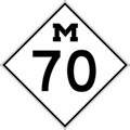
| Maps: |
Route Map of Former M-70 |
| Notes: |
 M-70 was a relatively minor state trunkline route which ran in Arenac and Ogemaw Cos for nearly 46 years. In an oddity among state trunkline routes, M-70 was cancelled as a trunkline route in 1942... for three days. The State Highway Commissioner rescinded the cancellation, even though the State Administrative Board had agreed four your prior that M-70 in its entirety no longer functioned as a state trunkline route. While the State Highway Commissioner gave the route a reprieve in 1942, seventeen years later in 1959, M-70 would be cancelled once and for all, and the M-70 designation has not been used in the state trunkline system since. M-70 was a relatively minor state trunkline route which ran in Arenac and Ogemaw Cos for nearly 46 years. In an oddity among state trunkline routes, M-70 was cancelled as a trunkline route in 1942... for three days. The State Highway Commissioner rescinded the cancellation, even though the State Administrative Board had agreed four your prior that M-70 in its entirety no longer functioned as a state trunkline route. While the State Highway Commissioner gave the route a reprieve in 1942, seventeen years later in 1959, M-70 would be cancelled once and for all, and the M-70 designation has not been used in the state trunkline system since. |
| History: |
1913 (Oct 9) – A 13.5-mile long state trunkline route is established in Arenac Co beginning in Standish at T.L. 10 (later M-10, now US-23) and continues northerly via Grove Street Rd, westerly along Wyatt Rd, northwesterly along present-day Old M-76 into Sterling, then northerly via Melita Rd to Melita, easterly on Main Street Rd for one mile to a termins at Dobler Rd. This new trunkline is given the designation of Trunk Line 70 (T.L. 70). |
| |
1915 (Sept 21) – Almost two years after its intial designation, the entirety of T.L. 70 is cancelled as a state trunkline highway route. Simultaneously, a 19.5-mile long state trunkline route is established in Arenac Co for T.L. 70 running along the entire 1913–1915 route but with an extension: Beginning in Standish at T.L. 10 (later M-10, now US-23) and continuing northerly via Grove Street Rd, westerly along Wyatt Rd, northwesterly along present-day Old M-76 into Sterling, then northerly via Melita Rd to Melita, easterly on Main Street Rd, northerly along Reed Rd, easterly via Maple RIdge Rd into Maple Ridge, then northerly along Briggs Rd to a terminus at the Arenac/Ogemaw Co line. |
| |
1915 (Sept 25) – A 9.95-mile long state trunkline route is officially established as a state trunkline route in Ogemaw and Iosco Cos, beginning at the northern end of T.L. 70 on the Arenac/Ogemaw Co line south of Prescott and continuing northerly via Sage Lake Rd 2 miles into Prescott, then via Greenwood Rd ½ mile, northly along Black Rd for a mile, jogging easterly on Craun Rd, then continuing northeasterly and northerly via Black Rd, turning easterly to run along Mills Rd (Ogemaw Co) and Prescott Rd (Iosco Co), terminating at the Whittemore village limit, ½ mile west (and shy) of T.L. 10 (later M-10, then US-23, now M-65). |
| |
1917 (Dec 18) – An additional ½ mile of state trunkline is officially established at Whittemore in Iosco Co running easterly from the terminus of T.L. 70 to a jct with T.L. 10 (later M-10, then US-23, now M-65). |
| |
1917–1919 – At some point in 1917, 1918 or 1919, the southernmost 21 miles of T.L. 70 from Prescott in Ogemaw Co southerly to T.L. 10 in Standish in Arenac Co is redesignated as a southern extension of T.L. 76. T.L. 70 now only exists as a 10.2-mile long trunkline connecting T.L. 76 at Prescott with T.L. 10 at Whittemore. |
| |
1919 (July 1) – T.L. 70 is signed in the field as M-70 as all state trunkline highways in Michigan are signed with route markers. |
| |
1925 (Sept 1) – A major change comes to the route of M-70 when a new, much more direct alignment for M-76 is designated between Sterling in Arenac Co and West Branch in Ogemaw Co. The former route of M-76 through central Ogemaw Co from West Branch to Prescott becomes part of an eastern extension of M-55. From Prescott, M-55 then continues northerly and easterly along the 1915–1925 route of M-70 to Whittemore, where it now termimates at M-10. While this supplants the entire existing route of M-70, the former segment of M-76 southerly from Prescott into Arenac Co via Maple Ridge and Melita to M-76 at Sterling is simultaneously redesignated as M-70—along a portion of the 1915–c.1917/18/19 route of T.L. 70. |
| |
1929 (Oct 1) – A new, more-direct alignment for M-55 is officially assumed into the state trunkline system in Ogemaw and Iosco Cos along Tawas Rd (its present-day route) from Clark Rd easterly to jct US-23 (present-day jct M-65) north of Whittemore. While the former route of M-55 from Prescott to Whittemore—the original route of M-70 prior to 1925—is simultaneously transferred to local control, the segment of M-55 from Prescott westerly via Harrison Rd/Greenwood Rd, then northerly along Clark Rd to M-55/Tawas Rd is redesignated as a northerly extension of M-70. M-70 now runs from M-76 in Sterling in Arenac Co to M-55 at Logan Corners in Ogemaw Co. |
| |
1938 (Nov 11) – On Armistice Day, the Highway Advisory Board authorizes the State Highway Dept to abandon M-70 in its entirety, ruling the highway "no longer serves an appreciable amount of through traffic and is more properly a local highway." Interestingly, M-70 would remain a state highway for several more years despite the Advisory Board's ruling. |
| |
1942 (Aug 17) – Nearly four full years after the Highway Advisory Board's ruling in 1938 that M-70 no longer serves "through traffic," the entire 22.7 mile route of M-70 is cancelled as a state trunkline highway, with agreements made to transfer the route back to local control. This would have resulted in the end of the M-70 designation anywhere in the state of Michigan... however, three days later there was a reversal... |
| |
1942 (Aug 20) – Just three days after the entire length of M-70 was cancelled as a state trunkline highway route, the State Trunkine Determination Maps as maintained by the State Highway Dept feature the following note: "This was reinstated by the Commissioner, August 20-'42." Essentially, the cancellation from Aug 17 was reversed by the G. Donald Kennedy, the State Highway Commissioner. Until 1965, the "director" of the Michigan State Highway Dept was an elected "State Highway Commissioner"—the only elected state highway commissioner in all of the existing 48 states! As such, the post of State Highway Commissioner was often more political than completely technical in nature. Although no evidence has been found to date to suggest the reversal of the M-70 cancellation was influenced by politics, but it would seem as though politics might have had some role in the decision. Regardless, while G. Donald Kennedy issued the M-70 cancellation reversal, approximately four months later, he would resign his post and be replaced by Lloyd B Reid for about three months until Charles M Ziegler was elected on Apr 5, 1943. |
| |
1958 (Sept 16) – The 6.0 miles of Sage Lake Rd from M-70 at the cnr of Harrison Rd & Sage Lake Rd in Prescott in Ogemaw Co northerly to M-55/Tawas Rd one mile east of Logan Corners is transferred to state control, as a future alignment of M-70. The former route of M-70 along Harrison Rd in Prescott from Sage Lake Rd westerly to Clark Rd and along Clark Rd from Harrison Rd northerly to M-55/Tawas Rd, however, is not transferred to local control and remains signed as the official route of M-70 for the time being. |
| |
1959 (July 21) – In a move foreshadowed in 1942, the entirety of the route of M-70 is transfered to local control in both Arenac and Ogemaw Cos. This includes both the segments originally cancelled as a state trunkline highway route in 1942 as well as the new 6.0-mile route officially established in 1958 in Ogemaw Co. As of this date, M-70 ceases to exist as a state trunkline designation in Michigan. |
| Controlled Access: |
No portion of M-70 was freeway or expressway. |
| Photographs: |
|
| Weblinks: |
|
| |
|