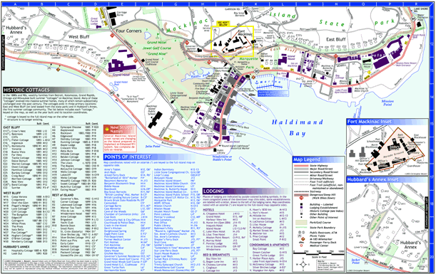
Mackinac Island Street & Trail Map
This site gives sample views of a complete and up-to-date map of Mackinac Island created by Christopher Bessert in 2003. Please note that the images featured on this page are much reduced in both size and quality (the actual map measures 11" x 17"). The "detail" images linked below, however, show a much more accurate representation of the level of detail on the map.
The map features some unique touches, including the locations of nearly every picnic table on the island, all public restroom facilities, all automated teller machines (ATMs), the M-185 milemarkers, the individual holes/greens numbered (Grand Hotel Front Nine and Woods Nine courses), as well as the newly-changed street names from the Enhanced-911 effort.
Front of Map
The front of the map contains a full-island view. It shows all roads, streets, foot trails, stairways, points of interest, etc. around the entire island. All features in the downtown area are included, however many are not labeled due to space constraints. Those downtown area features are labelled on the back of the map in an enlarged downtown inset (see below). The area included on the downtown inset map is clearly indicated on the front by a yellow line.

Map Details: Front
At right are links to two detailed, zoomed-in areas from the front of the map to clearly indicate the detail on the map itself. Also included is the map legend to give you an idea of what is included on the map.
Back of Map
The back of the map contains a double-scale (exactly twice the scale of the front of the map) blow-up of the downtown area, from Hubbard's Annex on the west to Robinson's Folly on the east and as far north as the Boy Scout Barracks behind the Fort and the Carriage Barns.
All important buildings are shown and labelled as are (on this edition of the map) all places of lodging, keyed to a listing on the bottom half of the page. Also included is a blow-up inset of Fort Mackinac, showing each building.

Map Detail: Back
One zoomed-in area from the back of the map is included at right to clearly indicate the detail on the map itself.
Contact
Questions about the Mackinac Island Map may be directed to its creator via any of the means listed at right. Hardcopies of the map for closer inspection may also be requested at the same address.
| Christopher
Bessert 1753 Morning Dew Drive SW Byron Center, Michigan 49315 (616) 878-4285 chris.bessert@gmail.com |