

The Zilwaukee Bridge: Annotated Aerial Image
An orthophotograph (rectified digital aerial photograph) of the Zilwaukee Bridge taken in April 1998, annotated to show the former alignment of the I-75/US-10/US-23 freeway alignment via the original (1960–1988) bascule span Zilwaukee Bridge.
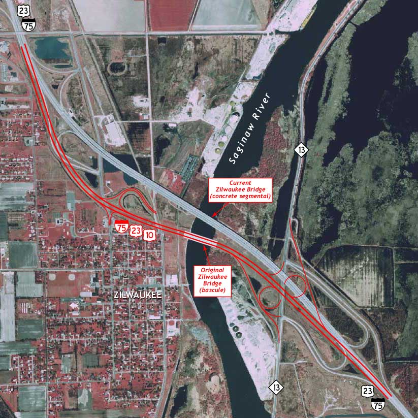
Source: Michigan Department of Natural Resources/Michigan Center for Geographic Information, April 1998.
Back to: Zilwaukee Bridge page