
|
Highways 140 through 159M-140 | US-141 | M-142 | M-143 | Former M-144 | Former M-145 | Former M-146 | Former M-147 | Former M-148 | M-149 | M-150 | Former M-151 | M-152 | M-153 | M-154 | M-156 | M-157 | Jump to Bottom | |||||||||||||
 |
PLEASE NOTE: The M-140 route information has moved to its own page: M-140 Route Listing. |
|||||||||||||
| PLEASE NOTE: The US-141 route information has moved to its own page: US-141 Route Listing. |
||||||||||||||
 |
PLEASE NOTE: The M-142 route information has moved to its own page: M-142 Route Listing. |
|||||||||||||
 |
PLEASE NOTE: The M-143 route information has moved to its own page: M-143 Route Listing. |
|||||||||||||
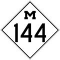 |
PLEASE NOTE: Former M-144 route information can be found on its own page: Former M-144 Route Listing. |
|||||||||||||
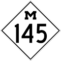 |
PLEASE NOTE: Former M-145 route information can be found on its own page: Former M-145 Route Listing. |
|||||||||||||
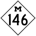 |
PLEASE NOTE: Former M-146 route information can be found on its own page: Former M-146 Route Listing. |
|||||||||||||
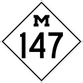 |
PLEASE NOTE: Former M-147 route information can be found on its own page: Former M-147 Route Listing. |
|||||||||||||
 |
PLEASE NOTE: Former M-148 route information can be found on its own page: Former M-148 Route Listing. |
|||||||||||||
 |
PLEASE NOTE: The M-149 route information has been moved its own page: M-149 Route Listing. |
|||||||||||||
 |
PLEASE NOTE: The M-150 route information has been moved its own page: M-150 Route Listing. |
|||||||||||||
 |
PLEASE NOTE: Former M-151 route information can be found on its own page: Former M-151 Route Listing. |
|||||||||||||
 |
PLEASE NOTE: The M-152 route information has been moved its own page: M-152 Route Listing. |
|||||||||||||
 |
Western Terminus: | M-14 at Exit 10 east of Ann Arbor | ||||||||||||
| Eastern Terminus: | US-12/Michigan Ave at I-94 Exit 210 on the western edge of the City of Detroit | |||||||||||||
| Length: | 25.197 miles | |||||||||||||
| Map: | Route Map of M-153 | |||||||||||||
| Notes: | M-153 is known as Ford Rd for its entire length. While most would logically assume the road's namesake was Henry Ford, the founder of the Ford Motor Company, the road was actually named for Henry Ford's father, an area farmer, political officeholder and community figure. The Fords had settled on land in Dearborn near present-day M-153. Not coincidentally, the present-day Ford Motor Company World Headquarters (known locally as the "Glass House") is located just south of M-153/Ford Rd in Dearborn. | |||||||||||||
| In the 1930s, M-153 was proposed to be the first leg in an overall "Detroit-Chicago Superhighway" which was to "eventually provide a new route across the State, keeping away from the centers of the larger cities." It could be considered a direct forerunner of today's I-94. | ||||||||||||||
| History: | 1930 (Dec 2) – A 47.4-mile long state trunkline highway route is officially established as part of the proposed "Detroit-Chicago Superhighway" eventually linking the two cities with a re-engineered "super" highway largely on new alignment. The concept of freeways, as they came to be known later in the 20th Century, had not yet fully coalesced and this proposed route was planned as a 40-foot wide (or wider, in places) concrete highway, engineered to the highest existing standards. The new route "will eventually provide a new route across the State, keeping away from the centers of the larger cities." (Detroit Free Press, Jan 14, 1934, Part 2, pg. 4) The first segment of the "Detroit-Chicago Superhighway", as officially established on this date, begins at US-112/Michigan Ave & Wyoming Ave between Detroit and Dearborn and continues westerly along Ford Rd to Canton Center Rd, then continues due westerly along an unconstructed alignment into Washtenaw Co to US-12/Plymouth Rd just northeast of Dixboro. The route then continued due westerly for an additional four miles before curving southwesterly as it crossed the Ann Arbor RR (present-day Great Lakes Central RR) north of Ann Arbor, continuing to US-12/Jackson Rd at Zeeb Rd west of Ann Arbor. The "superhighway" route continues westerly for ¾ mile along US-12/Jackson Rd for nearly 14 miles to just southwest of Sylvan. There, the route curved west-northwesterly for two miles, crossing existing US-12 and the Michigan Central RR before turning due westerly for an additional mile to the Washtenaw/Jackson Co line. From there, the "superhighway" route continues west on a gently curving alignment passing north of Riley Lake, between Grass and Tims Lakes and south of Goose Lake to the present-day intersection of Sargent Rd & Ann Arbor Rd northeast of Jackson. The highway route then turns southwesterly along present-day BL I-94/Ann Arbor Rd to Michigan Ave and then via Michigan Ave to the eastern Jackson city limit. From the outset, the portion of the "Detroit-Chicago Superhighway" along Ford Rd from US-12/Michigan Ave westerly to Canton Center Rd in Canton Twp and on to US-12 at Dixboro northeast of Ann Arbor is designated M-153., but state highway officials hoped to have Ford Rd designated as a "federal route," likely meaning transferred the US-12 designation from Plymouth Rd to the north onto Ford Rd. West of Ann Arbor, the highway officials planned to move the US-12 designation to the new route as it was completed and opened to traffic. |
|||||||||||||
| 1933 (Summer) – M-153/Ford Rd from Canton Center Rd in western Wayne Co westerly to Napier Rd on the Wayne/Washtenaw Co line is completed and opened to traffic as a 20-foot concrete roadway on a 120-foot right-of-way. The grading for the segment of M-153 from Napier Rd to US-12/Plymouth Rd near Dixboro is underway with an anticipated completion in a year. | ||||||||||||||
| 1934 (July) – The 20-foot concrete pavement is laid on M-153/Ford Rd from the Wayne/Washtenaw Co line westerly to US-12/Plymouth Rd near Dixboro and the signed, open highway now officially terminates at that point while plans for the northerly bypass of Ann Arbor are being finalized. | ||||||||||||||
| 1935 (Jan 7) – The portion of the M-153 northern bypass of Ann Arbor—officially established as a state trunkline in late 1930, but not yet constructed—is officially cancelled as a state trunkline highway route. The western end of the existing highway now officially becomes the western terminus of the route as well. The cancelled bypass, however, would come back in the 1940s as a northerly US-12 bypass of Ann Arbor with the western half actually being constructed, with some modifications, as the M-14 freeway between I-94 and BUS US-23/N Main St. | ||||||||||||||
| 1965 (Mar 31) – On the same date the portion of the M-14 freeway is officially established as a state trunkline highway from US-23 northeast of Ann Arbor to M-153, a new divided highway alignment of M-153 is similarly established from its existing alignment at Frains Lake Rd northwesterly to the end of the new freeway at Plymouth Rd. This completes a seamless connection with the new freeway. The former route of M-153 via Ford Rd westerly to Plymouth Rd is turned back to local control. | ||||||||||||||
| 1973 (Dec 14) – M-153/Ford Rd is reconstructed to freeway standards from Artesian St/Auto Club Dr (halfway between M-39/Southfield Frwy and Evergreen Rd) westerly to Golfview Dr, including interchanges at Evergreen Rd and Edward N Hines Dr, on the Dearborn/Detroit and Dearborn/Dearborn Heights city limit. The former westbound lanes of M-153 from Artesian St to just east of Evergreen Rd is renamed Altar Rd and remains an unsigned state trunkline for the time being, while the remainder of the former highway is either abandoned or is obliterated under the new construction. | ||||||||||||||
| 1980 (Feb 9) – The segment of the M-14 freeway from M-153 northeasterly to the Washtenaw/Wayne Co line is officially certified as a state trunkline highway and likely opens to traffic in the same timeframe. Thus, the route of M-153 is extended a very short distance along the former stub of M-14 freeway from Plymouth Rd to meet with the M-14 freeway. | ||||||||||||||
| 1985 (Jan 15) |
||||||||||||||
| Freeway/Expwy: | A short portion of M-153 from from Artesian St/Auto Club Dr westerly to Golfview Dr in Dearborn. | |||||||||||||
| NHS: | From Canton Center Rd in Canton Twp to eastern terminus in Detroit. | |||||||||||||
| Photographs: | ||||||||||||||
| Weblinks: | • M-153 @ Michigan Highway Ends – photos of the termini of M-153 at Dan Garnell's archived Michigan Highway Ends website. | |||||||||||||
 |
Southern Terminus: | End of Green Rd (beginning of Bates Hwy) on Harsens Island, 3.6 miles south of Sans Souci | ||||||||||||
| Northern Terminus: | Harsens Island Ferry landing on North Channel Drive on Harsens Island | |||||||||||||
| Length: | 6.207 miles | |||||||||||||
| Map: | Route Map of M-154 | |||||||||||||
| Notes: | M-154 is one of only three Michigan state highways on islands; the others are M-134 on Drummond Island and M-185 on Mackinac Island. | |||||||||||||
| Even though the island and M-154 are only connected to the mainland via Champion's Auto Ferry plying the North Channel waters, the auto ferry does run year 'round, as long as the ice does not become too thick to cut through. In February 2004, a cold snap froze the North Channel more solidly than usual, cutting off island residents from the mainland. In times such as these, the U.S. Coast Guard sends in a cutter to break through the ice and reopen the ferry lanes. Because of these occasional situations, some island residents and developers have been attempting to garner support to have a bridge built between the island and the mainland, although others are very much against it and the changes such a structure would bring to the island. | ||||||||||||||
|
||||||||||||||
| An MDOT source notes that around the year 2000, the department decided to truncate the route of M-154 to Ferry Dock Rd near its intersection with North Channel Rd at the "Y" intersection on the north end of Harsens Island. The remainder of what is signed as M-154 along North Channel Dr from the "Y" at Ferry Dock Rd westerly approximately ½ mile was then designated OLD M-154 and earmarked for a future jurisdictional transfer back to local control. It was also noted, though, that no corresponding changes have been made to the signage along the route, so OLD M-154 remains signed as if it was still part of M-154. | ||||||||||||||
| History: | 1931 (Jan 22) – The first state trunkline highway to be designated on an island occurs when M-154 is established as a 5.0-mile route on Harsens Island in southern Saint Clair Co. It begins in the Grand Pointe area on the northeastern tip of Harsens Island and proceeds westerly via North Channel Rd to Little Rd, then southwesterly via Little Rd (a portion of which no longer exists today) to La Croix Rd, southeasterly via La Croix to Green Rd, then southwesterly via Green Rd to a terminus at Clays Landing. While the rest of the roadway, known as Bates Hwy, to the southwestern tip of the island is never included in the trunkline routing, the State Highway Dept does improve the road the next year. | |||||||||||||
| 1932 (Oct 29) – M-154 is realigned on Harsens Island to continue northwesterly via La Croix Rd (instead of turning northeasterly onto Little Rd) to Columbine Rd, then northeasterly via Columbine to North Channel Rd and westerly via North Channel to the Algonac-Harsens Island ferry dock. A very short connection on the "mainland" takes ferry users to M-29/Point Tremble Rd. Much of the former route is turned back to local control, while a portion of Little Rd is abandoned as a public roadway. | ||||||||||||||
| 1933 (July 10) |
||||||||||||||
| 1939 (July 13) – A slight realignment 'cuts the corner' from La Croix Rd onto Columbine Rd, shaving 1/10th mile from the route. The former route is turned back to local control. | ||||||||||||||
| c.2000 – As noted in the Notes section above, MDOT officially truncates M-154 to Ferry Dock Rd & North Channel Dr, with the portion of North Channel west of the Ferry Dock "Y" intersection being designated as a turnback candidate, OLD M-154. No signage changes are made, however, and all of the new OLD M-154 route remains signed as M-154. | ||||||||||||||
| Freeway/Expwy: | No portion of M-154 is freeway or expressway. | |||||||||||||
| Photographs: | ||||||||||||||
| Weblinks: | • M-154 @ Michigan Highway Ends – photos of the termini of M-154 at Dan Garnell's archived Michigan Highway Ends website. | |||||||||||||
| • Champion's Auto Ferry – the current ferry schedule, fares and contact information. | ||||||||||||||
| • Harsens Island Ferry – a few 1996 photos of the automobile ferry connecting M-154 and the island to the mainland, courtesy of Tom Dean Associates. | ||||||||||||||
 |
Southern Terminus: | Ohio state line (connection w/OH SR-108) at Morenci | ||||||||||||
| Northern Terminus: | M-34 at Clayton | |||||||||||||
| Length: | 10.655 miles | |||||||||||||
| Map: | Route Map of M-156 | |||||||||||||
| Notes: | ||||||||||||||
| History: | 1931 (June 19) – The State Administrative Board approves a new 8.9-mile state trunkline route to connect Morenci with M-34 at Clayton in Lenawee Co. This is the second longest single segment approved out of a total of 30 additional miles of roadway to be added to the trunkline sytem. | |||||||||||||
| 1931 (Oct 24) – A new 10.2-mile long state trunkline beginning at M-34 at Clayton and proceeding southerly via Morey Hwy and Lime Creek Hwy to Morenci and through town via North, Main and East Sts to the Ohio State Line is established as M-156. | ||||||||||||||
| 1978 (___ 16) – A route with a new gentle double-curve immediately north of the community of North Morenci replacing several sharper ones is officially assumed into the trunkline system. The portion of the former route still open to traffic is temporarily retained in the system as well. | ||||||||||||||
| 1980 (Apr 3) – The segments still open to travel of the former M-156 bypassed by the realignment above, namely short portions of Lime Creek Hwy and Morey Hwy, are turned back to local control. | ||||||||||||||
| Freeway/Expwy: | No portion of M-156 is freeway or expressway. | |||||||||||||
| Continue on: | SR-108 into Ohio – John Simpson's Ohio Highways Website | |||||||||||||
| Photographs: | ||||||||||||||
| Weblinks: | • M-156 @ Michigan Highway Ends – photos of the termini of M-156 at Dan Garnell's archived Michigan Highway Ends website. | |||||||||||||
 |
Southern Terminus: | M-55/West Branch Rd 2.5 miles east of downtown Prudenville | ||||||||||||
| Northern Terminus: | M-18 2.6 miles northeast of downtown Prudenville | |||||||||||||
| Length: | 1.193 miles | |||||||||||||
| Map: | Route Map of M-157 | |||||||||||||
| Notes: | M-157 serves only as a short connector highway between M-18 and M-55 and is the fourth-shortest mainline state trunkline highway. | |||||||||||||
| History: | 1931 (Aug 10) – A new 1.0-mile long state trunkline highway designated M-157 is established in central Roscommon Co as a short-cut between M-55 and US-27 (present-day M-18) via Roscommon Rd. | |||||||||||||
| 1932 (Oct 29) – The existing 1.0-mile long iteration of M-157 is cancelled as a state trunkline and the roadway is abandoned as a public right-of-way. Simultaneously, a new iteration of M-157 on a slightly different alignment just to the east of the former route is officially assumed into the state trunkline system. Since the new alignment curves slightly to the east (the former ran due north-south), it is 1.5 miles in length, one-half mile longer than the previous M-157. Other than extremely minor realignments at either end of the highway to create 90-degree tee-intersections with M-55 and M-18, no other modifications have been made to the route of M-157 since 1932. | ||||||||||||||
| Freeway/Expwy: | No portion of M-157 is freeway or expressway. | |||||||||||||
| Photographs: | ||||||||||||||
| Weblinks: | • M-157 @ Michigan Highway Ends – photos of the termini of M-157 at Dan Garnell's archived Michigan Highway Ends website. | |||||||||||||
M-140 | US-141 | M-142 | M-143 | Former M-144 | Former M-145 | Former M-146 | Former M-147 | Former M-148 | M-149 | M-150 | Former M-151 | M-152 | M-153 | M-154 | M-156 | M-157 | Up to Top |
||||||||||||||
