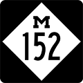
| Back to Previous Route: Former M-151 |
 |
On to Next Route: M-153 |
| Western Terminus: | Van Buren/Berrien county line (cnr 92nd Ave, Napier Ave & S County Line Rd) in the Sister Lakes area |
| Eastern Terminus: | M-51 five miles north of downtown Dowagiac |
| Length: | 7.702 miles |
| Maps: | |
| Notes: | |
| Contrary to appearances on a map, M-152 has never continued westerly via Napier Ave into the Benton Harbor/St Joseph area, even thought it seems such an extension would be rather logical. Historical State Highway Dept maps and documents indicate Napier Ave westerly from the Van Buren Co line has always been a locally-maintained roadway. Even with the (rather temporary) establishment of the portion of Napier from the new US-31/St Joseph Valley Pkwy westerly to I-94 in 2003, no plans were announced to transfer any other portion of Napier Ave to state control. (That segment of Napier Ave was eventually returned to Berrien Co control in late 2023.) | |
| According to internal MDOT sources, M-152 has long been marked as a prime "turnback candidate," meaning the department would rather see this route maintained locally rather than at the state level. One source maintains the Cass Co Road Commission was offered M-152 as a jurisdictional transfer in 2002 at the same time as the M-205-for-M-217 swap took place, however the county declined the state's offer but stated they would be willing to take M-216 off their hands. MDOT wasn't as receptive to that offer, which would make sense as M-216 connects with other state highways at either end (unlike M-152) and transferring to Cass Co its portion of M-216 would result in either yet another spur trunkline route ending at a county line (e.g. M-216 would end at the St Joseph/Cass Co line) or the creation of yet another unsigned trunkline route (e.g. MDOT would remove the route markers from the remnant portion of M-216 in St Joseph Co). | |
| Additional details on M-152 from a retired MDOT employee shed even more light on the tenuous existence of this longtime spur route:
Notes on a possible turnback in 1967 state: "The existing facility is essentially a gravel county road, absorbed into our system in 1933, and to which has been added a number of seals over the years. The road serves primarily the resort and vacation areas in the Sister Lakes region and the fruit growers in this corridor." Turnback was attemped over the years, but consensus was not reached over the condition to which M-152 should be brought by MDOT, prior to turnback. Although PA 296 of 1969 provides for non-consent turnbacks through an arbitration process, these provisions are not currently used by MDOT.
Many thanks to Susan Berquist! |
|
| History: | 1928 (Oct 19) – The State Highway Dept advisory board designates, pending approval by the State Administrative Board, a new, six-mile long state trunkline route beginning at M-40 (present-day M-51) north of Dowagiac to the Van Buren/Berrien Co line. No route designation is assigned to the newly proposed route at this time. |
| 1929 (Oct) – The State Administrative Board approves a new, six-mile long state trunkline route beginning at M-40 (present-day M-51) in southwestern Van Buren Co passing to the north of the Sister Lakes area, "to connect with the east end of a macadam road in Berrien Co" at the Van Buren/Berrien Co line. | |
| 1930 (Apr 11) – Rescinding its order of six months prior, the State Administrative Board then simultaneously approves a the state trunkline route beginning at M-40 (present-day M-51) in northwestern Cass Co passing through the heart of the Sister Lakes area, "to connect with the east end of a macadam road in Berrien Co" at the Van Buren/Berrien Co line. The length of the new trunkline route remains approximately six miles long. | |
| 1933 (May 24) – A new, 7.7-mile long trunkline spur route as M-152 is officially established as a state trunkline route in northwestern Cass and southwestern Van Buren Cos, beginning at M-40 (present-day M-51) north of Dowagiac and running westerly, then northerly and westerly again through the Sister Lakes area, terminating at the Van Buren/Berrien Co line. (An aside: The route of M-152 first appears on official state highway maps, however, two years earlier in 1931. It is unclear when signage may have appeared in the field.) No changes to the route of M-152 have taken place since. | |
| 1945 – M-152 is completely hard-surfaced throughout. | |
| 1967 (July 1) |
|
| Controlled Access: | No portion of M-152 exists as freeway or expressway. |
| NHS: | No portion of M-152 is on the National Highway System (NHS). |
| Photographs: | |
| Weblinks: |
|
| Back to Former M-151 | Route Listings Home | On to M-153 |

