

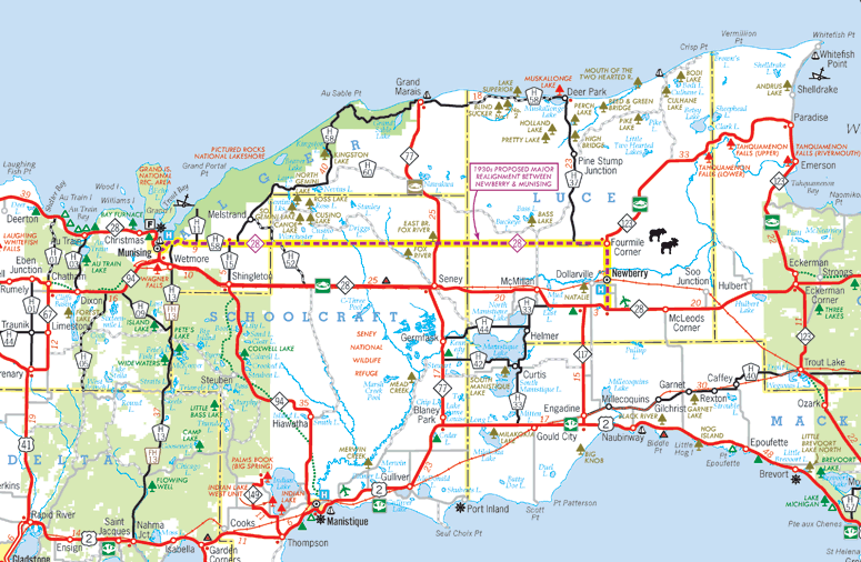
M-28: 1930s Proposed Realignment
The map below illustrates a possible major realignment of M-28 between Newberry and Munising studied during the 1930s, overlaid onto a modern-day highway map. (See M-28 route listing for details.)
 Map ©2015 Christopher J. Bessert. All Rights Reserved. Please do not duplicate or use elsewhere
without first requesting permission to do so. Thanks!
Additional Information