

Former M-2 & Proposed M-2 Route Maps
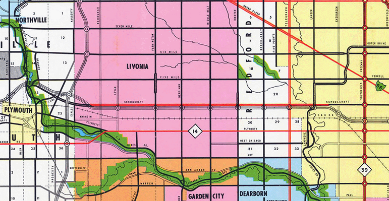
1970s Route Map
Below is a route map showing the Former M-2 along Schoolcraft Rd as depicted on a Wayne County Road Commission county road map from 1969. Jump to 1990s–2002 Route Map.
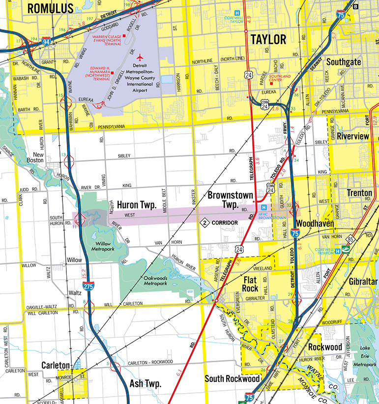
1990s–2002 Route Map
Below is a map of the Proposed M-2 corridor in southern Wayne Co which was under consideration from c.1990 to 2002. Jump to 1970s Route Map.
Back to Top of Page.
Back to Former M-2 Route Listing.