Michigan Highways: Since 1997.

Michigan Highways website header graphic
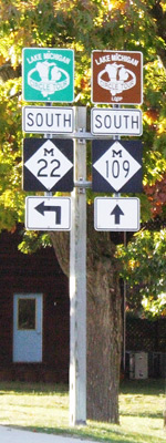
M-22 & M-109 junction route signage in Glen Arbor, Michigan

M-35 Route Maps

Jump to: M-35 Current Route Map | M-35 Maximum Extent Map (1927–34)

Current Route Map

M-35 Route Map
Map Copyright ©2022 Christopher J. Bessert, All Rights Reserved. Please do not copy without permission.

M-35 Maximum Extent (1927–1934)

The map below is a modified snippet of the April 1, 1930 Michigan Official Highway Map issued by the Michigan State Highway Department, showing the farthest extent of the route of M-35 from 1927 to 1934. (State Highway Dept planners had actually earmarked the Silver City-to-Bergland trunkline route to be an even farther extension of M-35, which would have started it towards becoming a "U-shaped" route, but that segment ultimately became part of M-64, which also took over the part of M-35 west of Ontonagon. See the History Section of the M-35 route listing for full details.)

Click/tap on the map below to see a larger, higher-resolution version.

M-35 Maximum Extent Route Map, 1930This map presentaiton copyright ©2026 Christopher J. Bessert, All Rights Reserved. Please do not copy without permission.


Back to M-35 Route Listing.