Michigan Highways: Since 1997.

Michigan Highways website header graphic
M-22 & M-109 junction route signage in Glen Arbor, Michigan

Former M-146 Route Maps
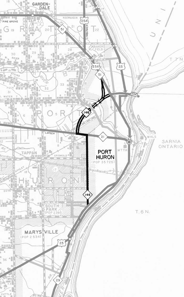
1956 Route Map

Below is a route map showing M-146 as depicted on a Michigan State Highway Dept General Highway Map of St. Clair Co from 1956. Jump to 1964 Route Map.
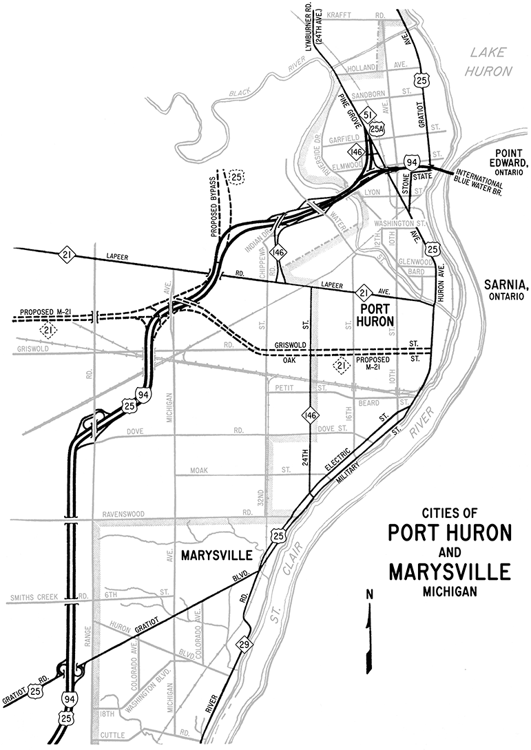
Former M-146 Route Map, 1956
This map presentation, Copyright ©2024 Christopher J. Bessert, All Rights Reserved. Please do not copy without permission.

1964 Route Map

Below is a route map showing M-146 and other state trunkline routes—both existing and proposed—in the Port Huron and Marysville areas as of 1964. Jump to 1956 Route Map.

Former M-145 Route Map, 1953
This map presentation, Copyright ©2024 Christopher J. Bessert, All Rights Reserved. Please do not copy without permission.

Back to Top of Page.

Back to Former M-146 Route Listing.