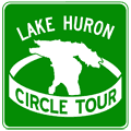
Lake Huron Circle Tour
 The Lake Huron Circle Tour (LHCT) is one of four Great Lakes Circle Tours, each of which run through portions of Michigan. What sets the LHCT apart, though, is this route is the only one touching just two jurisdictions—Michigan and Ontario. The LHCT was officially designated soon after the debut of the Lake Michigan and Lake Superior Circle Tours. It joins the LMCT as one of the two which traverse both of Michigan's peninsulas as well as crossing the Mackinac Bridge.
Lake Huron Circle Tour Route
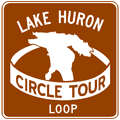
In Michigan, the mainline of the LHCT follows signed state trunkline routes in its entirety, although in some places the nearest state highway to the Lake Huron may be several miles away. This route listing lists the official route as well as any locally-designated and marked "Lake Huron Circle Tour Loops," which are generally posted with brown signs. These loop routes are detailed below the mainline route below:
- The LHCT enters Michigan from Ontario via the Bluewater Bridge in Sarnia.
- The tour takes the first exit past US Customs and heads north out of Port Huron via M-25.
- The route continues on M-25 along the Lake Huron and Saginaw Bay shorelines taversing the entire Thumb between Port Huron and Bay City.
- At Bay City, the LHCT departs M-25 and turns northerly to follow M-13 toward Standish.
- When M-13 ends at US-23 south of Standish, the route continues northerly via US-23 parallel to the Saginaw Bay and Lake Huron shores through Tawas City, Oscoda, Alpena, Rogers City and Cheboygan.
- At the northern terminus of US-23 in Mackinaw City, the LHCT veers north to follow I-75 over the Mackinac Bridge and into the Upper Peninsula.
- At the north end of the Mackinac Bridge, the circle tour exits I-75 at Exit 344A and follows BL I-75 through downtown St Ignace.
- North of St Ignace, the LHCT re-joins I-75 at Exit 348 and continues northerly.
- The route leaves I-75 at Exit 359 and continues easterly along M-134 through Cedarville to M-48.
- At this point, a LHCT Loop Route continues easterly on M-134 into De Tour Village, then doubles back via North Caribou Lake Rd, terminating at M-48/LSCT a few miles north of the M-48 & M-134 junction.
- The mainline LHCT turns northerly from M-134 and continues northwesterly on M-48 through Goetzville to M-129.
- The route continues northerly on M-129 through Pickford and into Sault Ste Marie.
- In Sault Ste Marie, the circle tour turns westerly from the end of M-129 on BS I-75.
- At I-75 Exit 392, the route turns northerly to traverse the final three miles of I-75 and crosses the International Bridge into Sault Ste Marie, Ontario.
- Continue on the Lake Huron Circle Tour into Ontario at the Ontario Highways website.
Back to: Great Lakes Circle Tour page.
Lake Huron Circle Tour Loop Route
 Lake Huron Circle Tour - Loop Route (De Tour Village)
A locally-designated loop route which helps circle tour motorists navigate into and through the off-route community of De Tour Village, the jumping-off point for the ferry to Drummond Island. As with all Loop Routes, this route is designated with white-on-brown circle tour signs, using the same LHCT "logo." The route:
- The LHCT Loop Route begins at the jct of M-134 & M-48 between Cedarville and De Tour Village and continues easterly on M-134 toward De Tour Village.
- The route enters De Tour Village on M-134, but continues northerly through the village when M-134 turns east toward the Drummond Island Ferry dock.
- On the north end of town, the loop route turns west and follows North Caribou Lake Rd.
- The loop route ends at M-48/LHCT a few miles north of the jct of M-134.
Additional Information
- Great Lakes Circle Tour – new website from the author of MichiganHighways.org.
- Great Lakes Circle Tour – project archive from the Great Lakes Commission. It was the GLC who originally helped establishe the Great Lakes Circle Tours, however as of the early 2020s, the Commission has seemed to have abandoned the concept and no longer supports the Circle Tours in an active manner.
- Lake Huron Circle Tour (archived) – from the Great Lakes Information Network (GLIN), which "is a partnership that provides one place online for people to find information relating to the binational Great Lakes-St. Lawrence region of North America." Although, note the route description on this website is very vague and actually cuts off several portions of the route!

