New Mixed-Case Clearview Signage, May 2008
It seems as if MDOT may be moving to using mixed-case Clearview on newer non-freeway trunkline signage. Since 2005, they have been actively replacing all freeway-related signage with new signs featuring Clearview, although off-freeway examples of Clearview have been very rare to this point. On a short roadtrip to southwest Michigan in mid-May 2008, the following interesting examples of mixed-case Clearview signage were found along M-60 between the Cass/St Joseph Co line and US-131, with another example on US-131 south of Schoolcraft. The signage seems rather inconsistent, though, and one has to wonder if this stretch of highway is being used as a Clearview test lab or something.
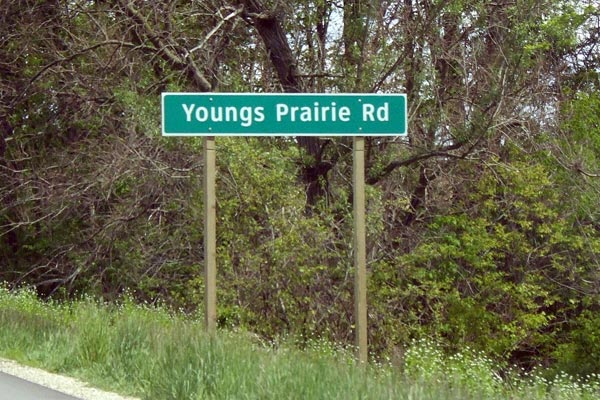 The advance roadname sign for Youngs Prairie Rd on eastbound M-60 southwest of Three Rivers. If you look closely, this sign not only eschews the traditional "rounded border" found on all state trunkline signage (see next photo for an example), but the "Youngs Prairie Rd" legend is not centered vertically on the sign. Photo ©2008 by Christopher J. Bessert. All Rights Reserved. |
 This sign pointing to Martin Rd sits along US-31 in Charlevoix Co and is provided here to contrast with the newer Clearview-based signs featured on this page. Photo ©2008 by Christopher J. Bessert. All Rights Reserved. |
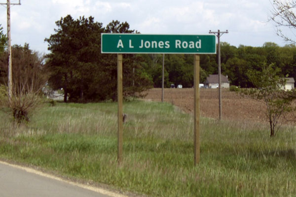 The advance roadname sign for A L Jones Rd on ebd M-60 southwest of Three Rivers. In addition to the different border style (see Youngs Prairie Rd sign), it also completely spells out the word "Road," which is against MDOT and FHWA convention. (Plus, there seems to be a great deal of extra space either side of the road name.) The road name is vertically centered, but this may be due to there being no decenders on this sign. Photo ©2008 by Christopher J. Bessert. All Rights Reserved. |
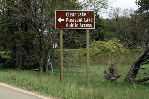
The sign on ebd M-60 southwest of Three Rivers pointing toward the public access sites on Clear and Pleasant lakes. It uses a rather narrow version of Clearview along with a slightly different looking arrow. The version of Clearview uses here seems too narrow for the sign to be able to properly convey its message. (This sign was still present as of 2018.) Photo ©2008 by Christopher J. Bessert. All Rights Reserved. |
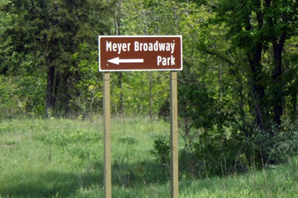 The sign on ebd M-60 southwest of Three Rivers pointing toward Meyer Broadway park. It uses the same rather narrow version of Clearview as with the public access sign above. The sign legend feels way too narrow on this sign as well. The next wider version of the typeface should be used. Also note how the sign barely fits between the wooden posts (compare with space and proportion with the public access sign above). But the wierd arrow takes the cake. This arrow is what leads me to wonder if this stretch of M-60 is being used as a sign testing site. The style of the standard arrow is much clearer and provides better visual layout. (This sign was replaced by a more standard version, albeit using Clearview, between 2009 and 2013.) Photo ©2008 by Christopher J. Bessert. All Rights Reserved. |
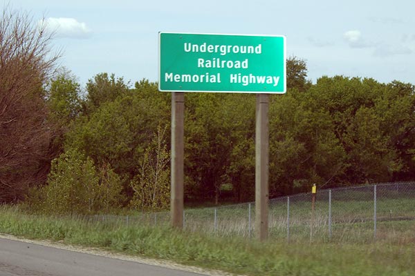
A newer Underground Railroad Memorial Highway sign on nbd US-131 near the St Joseph/Kalamazoo Co line between Moorepark and Schoolraft. This sign is one of only a small number of non-freeway, mixed-case Clearview signs on trunklines in Michigan. Photo ©2008 by Christopher J. Bessert. All Rights Reserved. |
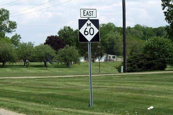 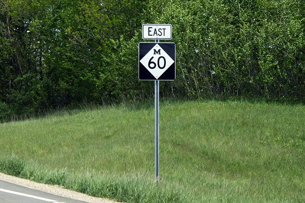 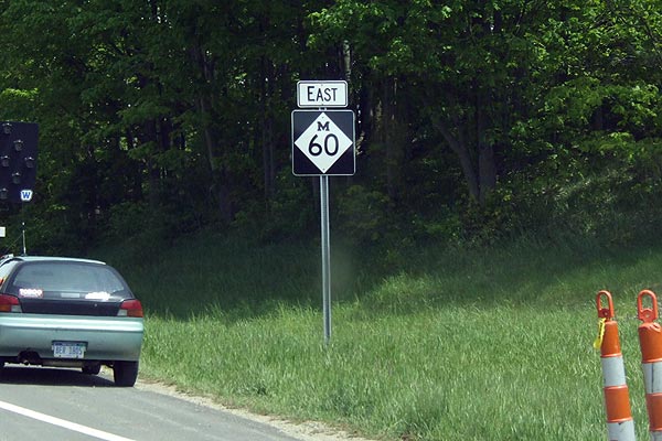 Newer M-60 reassurance markers between the Cass/St Joseph Co line and Three Rivers. In a break with convention, much larger than normal reassurance markers were used along this stretch for some reason. The "EAST" and "WEST" plates are normal size, but the route markers themselves are much larger, possibly the size used along freeways. (The larger route markers were still present as of 2018.) Photo ©2008 by Christopher J. Bessert. All Rights Reserved. |

