Mackinac
Straits Historical Photos
Below are a few photographs of the Mackinac Straits area before, during
and after the construction of the Mackinac Bridge. Additional photographs
and information are planned for the future.
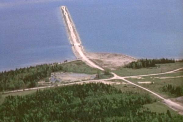
Aerial shot of the original 1930s Mackinac Bridge
Causeway for the aborted multi-span suspension bridge. Work was halted
on this first bridge by World War II, however the causeway ended
up saving the 1950s Mackinac Bridge Authority a great deal of money!
The east-west road crossing the causeway approach at a right-angle
is the now-abandoned Graham St. (c.1954) Source: Mackinac Bridge Authority Archives.
|
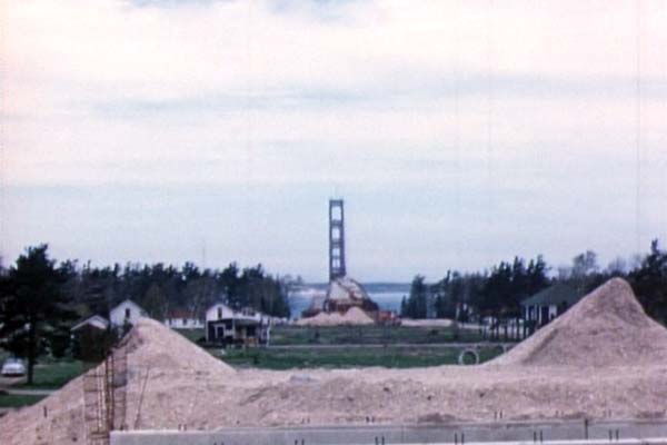
A shot from the partially-complete Central Avenue
overpass in Mackinaw City looking north. The Mackinac Bridge is within
18 months of being complete, yet the southern approach is just underway.
Trees and structures have been cleared, but additional fill is needed.
(Spring 1956) Source: Mackinac Bridge Authority Archives. |
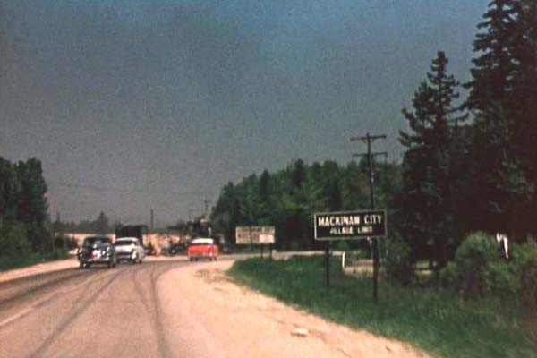
US-31 northbound (present-day Nicolet Ave, formerly M-108)
at the southern Mackinaw City village limit as it veers easterly
toward the State Ferry Docks via present-day Old 31. Nicolet Avenue
to the north has been closed and the roadway is being raised to meet
the realigned US-23/US-27 route at the new, higher grade level. (Summer 1956) Source: Mackinac Bridge Authority Archives. |
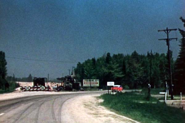
A closer view from the previous image, as US-31
veers to the right from present-day Nicolet Ave (formerly M-108) onto present-day
Old 31. You can see the amount of fill required to bring
Nicolet Ave up to the new US-23/US-27 intersection. (Summer 1956) Source: Mackinac Bridge Authority Archives. |
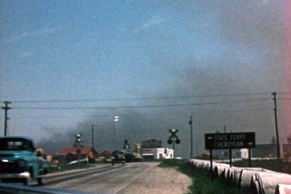
US-31 northbound as it approaches US-23/US-27
(Huron St) on the south side of Mackinaw City. The railroad in the
photo is the New York Central (later Detroit & Mackinac, abandoned
since the mid-1980s) while the State Highway Department sign directs
traffic to the left for "STATE FERRY" or right to "CHEBOYGAN." The
cloud of black smoke in the background shows the car- and auto ferries
are in operation. The cement pipe on the right side of the road is
part of the US-23/US-27 relocation project. (Summer 1956) Source: Mackinac Bridge Authority Archives. |
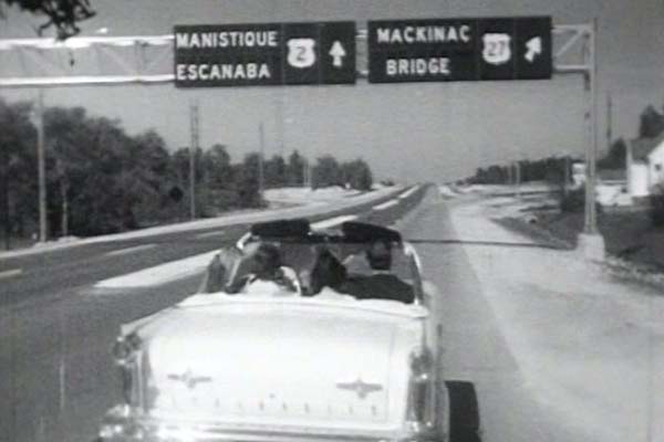
Looking westbound along US-2 at the new interchange
just north of the Mackinac Bridge. When first opened, this interchange
was a simple "trumpet" used to connect the new bridge with
US-2 west of St Ignace. This photo also offers direct proof that
US-27 was, indeed, the second state trunkline designation to cross
the Straits of Mackinac (US-31 was the first in the 1930s, I-75 became
the third a few years after this photo was taken). The US-27 ramp
shown here is now the I-75 NORTH ramp toward Sault Ste Marie. (June 25,
1957) Source: Mackinac Bridge Authority Archives. |
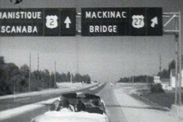
A closer view of the sign from the previous image.
In the late-1950s, it seems large, overhead signs such as these were
constructed in "pieces." Each letter seems to be a separate
component, while the route marker section and the arrow are other
sections. (June 25, 1957) Source: Mackinac Bridge Authority Archives. |
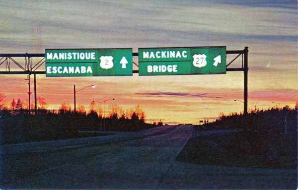
A color postcard view of the same sign as depicted on Opening Day views above, but this shows why the sign appeared to be "segmented": It was an internally lit sign! It is not clear whether there were other, similar signs elsewhere around the state at the time or if this was a unique installation. (1957) Source: Unidentified postcard view. |
Related Route Listings

