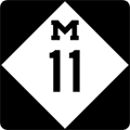
| Western Terminus: |
I-96 at Exit 24 just east of Marne |
| Eastern Terminus: |
I-96 at Exit 44 between Kentwood
and Cascade (southeast of Grand Rapids) |
| Length: |
20.933 miles |
| Map: |
Route Map of M-11 |
| Notes: |
Today's M-11 occupies two of the originally-proposed four legs in a complete Grand Rapids "Beltline" highway system, designated M-114. The southern and western legs of the beltline were run along existing roads, today's 28th St and Wilson Ave, respectively. The eastern leg was built and called, obviously, East Beltline—a name which it has today. The northern leg, which was to run in part along 3 Mile Rd, was never completed. Originally designated M-114, the southern and western portions of the Beltline had several designations over the years, including: BYP US-16, BYP M-50, BYP US-131, and BYP M-21; then as the former routes though town became Business Connections, US-16, M-50, US-131 and M-21 all ran along portions of the route. M-37 also occupied a portion of the route at different times over the years. With the completion of I-96 and I-196 at Grand Rapids in the 1960s, US-16 along 28th St, Wilson Ave and Ironwood Dr was redesignated as M-11. |
| |
A new "South Beltline"—this time a freeway bypass of Metro Grand Rapids—was constructed in the late 1990s and early 2000s. The route, M-6, roughly parallels M-11 between I-96 on the southeast and I-196 on the southwest. While the M-6 freeway has alleviated some of the heavy traffic volumes along many of hte east-west roads and streets in the area, M-11/28th St being a prime example, no serious efforts have been initiated to turn back any portion of M-11 to local control and it is expected to remain a state trunkline into the future. |
| History: |
1920 – The first iteration of M-11 in Michigan runs along the west side of the Lower Peninsula along the route which later becomes US-31, with the exception of the portion between New Buffalo and Saint Joseph, which is later signed as US-12. The entire length of this early M-11 is also designated the "West Michigan Pike." |
| |
1921 – M-11 is realigned in Emmet Co between Petoskey and Alanson. From Conway, M-11 formerly ran northerly on present-day North Conway Rd, easterly on Powers Rd, then southerly on the present Luce St into Oden, where it turned eastearly toward Alanson. A segment of new highway is completed directly linking Conway and Oden along the shore of Crooked Lake, with the former route being turned back to local control. |
| |
1921 (Oct 31) – The Benton Harbor City Commission approve a resolution altering the routing of trunkline traffic through the downtown area. Eastbound M-11/M-17 traffic from the St Joseph River bridge continues easterly via Main St to Fair Ave, then northerly one block on Fair Ave to Territorial Rd where the trunklines turn easterly again via Territorial. Westbound traffic coming into the city along Territorial Rd continue through along Territorial to Water St, then turn southerly one block via Water to Main St where M-11/M-17 traffic rejoin the eastbound traffic coming from St Joseph. The City Manager is instructed to communicate the change to the State Highway Commission in order to make the routing official. (This resolution seems to imply the M-17 designation continues concurrently with M-11 from its jct in Watervliet through Benton Harbor to a likely western terminus at Saint Joseph where M-11 turns southerly along the Lake Michigan shoreline toward Indiana.) |
| |
1922 – M-11 is rerouted onto new alignment in Ottawa Co, from West Olive northwesterly to Ferris St between Agnew and Grand Haven, with the former 'stair-step' route in the area being turned back to local control. Also in 1922, M-11 is realigned onto a more direct route between Montague in Muskegon Co and New Era in Oceana Co (present-day Oceana Dr). The former route (along present-day Dowling Rd, Post Rd, Old 99 Rd, Meinert Rd, Indian Bay Rd, 56th Ave, Arthur Rd, 64th Ave and Hayes Rd) is turned back to local control. |
| |
1926 – With the creation of the US Highway system, M-11 between the Indiana state line and St Joseph is designated as part of the new US-12, from St Joseph through Benton Harbor to Watervliet, it becomes a concurrent US-12/US-31 routing, and from Watervliet northerly to Mackinaw City, it is designated as a part of US-31. (Even in present times, a few short segments of what was originally M-11 can be found as roads named "Old M-11.") The M-11 designation is then immediately applied to a route running from M-50 at Napoleon, heading easterly through Manchester, ending at US-112/Michigan Ave in Saline southwest of Ann Arbor. |
| |
1948 – M-11 is completely hard-surfaced along its entire route from Napoleon to Saline. |
| |
1954 – With the routing of M-92 (later M-52) through the Manchester area, partially along the M-11 corridor just east of Manchester, M-11 is removed from Michigan as a state trunkline designation. It would be absent for seven years. |
| |
1961 – The third iteration M-11 is created when the US-16 routing is transferred to the newly finished I-96 and I-196 (later I-96) freeways around the north side of Grand Rapids. The former US-16 along 28th St, Wilson Ave and Ironwood Dr on the south and west sides of Grand Rapids becomes M-11. |
| Controlled Access: |
No portion of M-11 is freeway or expressway. |
| NHS: |
The entire length of M-11 is part of the National Highway System (NHS). |
| Memorial Highway: |
At present, no portion of M-11 has been designated as part of a Memorial Highway. |
| Photographs: |
|
| Weblinks: |
|


