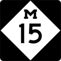
| Back to Previous Route: M-14 |
 |
On to Next Routes: Historic US-16 & M-16 |
| Southern Terminus: | US-24/Dixie Hwy just south of Clarkston |
| Northern Terminus: | M-25 in eastern Bay City (cnr Center Ave & Tuscola Rd) |
| Length: | 69.660 miles |
| Map: | Route Map of M-15 |
| Notes: | From the Ortonville area north to Bay City, M-15 has been designated as a Recreational Heritage Route by MDOT. Communities along the route of M-15 promote the route as a scenic alternative to I-75 from Metro Detroit northerly to the Tri-Cities area, in order to capture some of the abundant tourist traffic heading north along that major corridor. Unfortunately, M-15 is in need of upgrading from Clarkston to Davison, and traffic can sometimes be very heavy along the route. |
| Regarding the Heritage Route, MDOT states: "From Clarkston to Bay City, Michigan’s very first Recreational Heritage Route parallels I-75, offering motorists pleasant surprises and a welcomed diversion from fast paced freeway travel. Clarkston kicks things off at the south end with its summer festivals, parades and outdoor concerts. There’s plenty of camping, fishing and hiking to do along the 85-mile route. Just a few miles from Millington is the Murphy Lake State Game area, a great source of hunting land, trails, lakes and streams. The route concludes just east of downtown Bay City, where marinas, museums, galleries, a lighthouse and a magnificently restored city hall await travelers." The name of this route has evolved into the Pathway to Family Fun Recreational Heritage Route. | |
| A 1933 highway map shows a proposed M-15 highway running southerly from Clarkston through southern Oakland Co, passing Farmington to the west and skirting Northville and Plymouth to the east, through Belleville to the Wayne/Monroe Co line. This proposed highway would have served as a western bypass of the Detroit area. While the entire highway was not built and M-15 never ran south from Clarkston, much of this proposed road was actually built from Pontiac Tr near Walled Lake souterly through southern Oakland Co and most of Wayne Co—today's Haggerty Hwy. The general route of Haggerty Hwy became, 45 years after it was first proposed, part of the I-275 corridor. | |
| History: | 1920 – Prior to the creation of the US Highway system, M-15 runs along the general alignment of present-day US-41 from Wisconsin at Menominee, through Escanaba, Gladstone, Marquette, Ishpeming, L'Anse, Houghton and Hancock, ending at Copper Harbor. |
| 1922 (June 10) – Although officially established as part of M-15 on April 1, 1919, construction on the segment of M-15 in Baraga Co from Tioga northerly to L'Anse was so difficult that it has taken the better part of four years to complete the entire segment, with the last portion to be finished being the bridge spanning Pelkie Creek. The remainder of M-15 between Tioga and the Baraga/Houghton Co line has been open since 1921. Prior to completion of the new route, traffic is routed over the former route along Nestoria-Herman Rd although a miscommunication between the State Highway Dept and the Baraga Co Road Commission led to M-15 route markers not being erected along the temporary route for at least a year until the mistake was rectified in late 1920 or early 1921. | |
| 1925 – As originally proposed in 1925, M-15 was scheduled to be replaced by three different US Highways in four segments. From the Wisconsin line to Powers, M-15 was to be designated US-41, while from Powers to Rapid River, it was to become part of US-2. From Rapid River to Covington, M-15 was proposed to be designated US-102, while the remainder from Covington to Copper Harbor was to be, again, part of US-41. | |
| 1926 – Unlike what was proposed in 1925, the final US Highay replacement for M-15 in Michigan was decided to be solely US-41 throughout. The M-15 designation is removed from that route and almost immediately transferred to a new state trunkline routing in the Lower Peninsula. This new highway begins at US-10 (present-day US-24) in Clarkston and proceeds northerly through Davison and Otisville, ending at M-38 & M-24 in Vassar. | |
| 1935 (May) |
|
| c.1937 – By 1937, the northern termini of both M-15 and M-24 were scaled back to end at M-25/Center Ave in eastern Bay City. The 1937–1959 routing of M-15 was, ironically, identical to its 1970–present routing. | |
| 1942 (Apr 18) |
|
| 1959 – The M-15 designation extended from its northern terminus at M-25/Center Ave in Bay City westerly concurrent with M-25 and BUS US-23 to US-23/Euclid Ave (present day M-13), much as it had from 1934 to 1937. | |
| 1960 – The M-15/M-25 designation is extended westerly from M-13/Euclid Ave to the newly completed I-75/US-23/US-10 freeway west of Bay City. | |
| 1970 – After only a decade running concurrently with M-25 through downtown Bay City, M-15 is once again scaled back to its pre-1959 terminus in Bay City at M-25/Center Ave. | |
| 1996 – Much of M-15 is designated as a Recreational Heritage Route. | |
| Controlled-Access: | No portion of M-15 is freeway or expressway. |
| NHS: | M-15 is part of the National Highway System (NHS) from its southern terminus at US-24/Dixie Hwy near Clarkston to Flint St in downtown Davison, east of Flint. (23.2 miles) (The segment from I-75 at Exit 91 north to Davison was added in 2012 with the passage of the MAP-21 funding and authorization bill.) |
| Pure Michigan Byway: |
|
| Memorial Highway: | The following Memorial Highway designations have been officially assigned to parts of M-15 by the Michigan Legislature:
|
| Photographs: | |
| Weblinks: |
|
| Back to M-14 | Route Listings Home | On to Historic US-16 & M-16 |

