

The Michigan Left: Photos & Plans
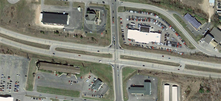
Aerial view of a Michigan Left Configuration along
US-41/M-28 at McClellan Ave in Marquette, in the central Upper Peninsula.
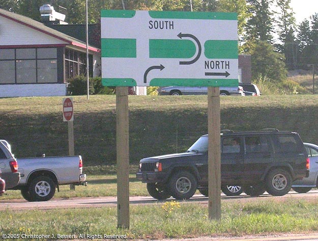
While
diagrammatic signage is often present along sideroads intersecting a divided
highway where Michigan Lefts are used, this one on McClellan Ave at US-41/M-28
in Marquette (at the location pictured in the aerial shot above) is overly diagrammtic.
However, since Michigan Lefts are less common in the Upper Peninsula than they
are downstate, such additional detail is likely necessary. Photo ©2005
Christopher J. Bessert, All Rights Reserved.
 Barry
L. Camp snapped a photo of a rather unique I-96 trailblazer route marker assembly
in central Kent County, just east of Grand Rapids. In addition to the usual "TO" and "I-96" markers,
the arrow at the bottom of the assembly actually illustrates the movement required
to get from northbound Spaulding Ave onto westbound M-21/E Fulton St (and toward
I-96) via the Michigan Left. Barry snapped the photo in May 2005 and reports that by May of 2007 it had been removed. (Thanks to Barry for allowing the use of the photo!)
Barry
L. Camp snapped a photo of a rather unique I-96 trailblazer route marker assembly
in central Kent County, just east of Grand Rapids. In addition to the usual "TO" and "I-96" markers,
the arrow at the bottom of the assembly actually illustrates the movement required
to get from northbound Spaulding Ave onto westbound M-21/E Fulton St (and toward
I-96) via the Michigan Left. Barry snapped the photo in May 2005 and reports that by May of 2007 it had been removed. (Thanks to Barry for allowing the use of the photo!) 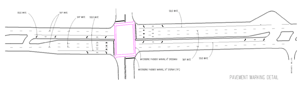
Plans for a Michigan Left Configuration near Grand Rapids where a Michigan
Left will be situated on a narrow right-of-way. View
a full-detail PDF of drawing. (Source: Grand
Valley Metropolitan Council, 2004)