Michigan Highways
Home | Highway Listings | County Highways | Other Highways | In-Depth: News & Articles | About this Site


Highways 120 through 139

M-120 | M-121 | Former M-122 | M-123 | M-124 | M-125 | Former M-126 | US-127 | M-129 | Former M-130 | US-131 | M-134 | M-136 | Former M-137 | M-138 | M-139 | Jump to Bottom


M-120
PLEASE NOTE:
The M-120 route information has moved to its own page: M-120 Route Listing.

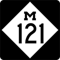
M-121
PLEASE NOTE:
The M-121 route information has moved to its own page: M-121 Route Listing.

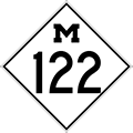
Former M-122
PLEASE NOTE:
Former M-122 route information now has its own page: Former M-122 Route Listing.

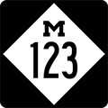
M-123
PLEASE NOTE:
The M-123 route information has moved to its own page: M-123 Route Listing.

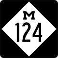
M-124
PLEASE NOTE:
The M-124 route information has moved to its own page: M-124 Route Listing.

M-125
PLEASE NOTE:
The M-125 route information has moved to its own page: M-125 Route Listing.

Former M-126
PLEASE NOTE:
Former M-126 route information now has its own page: Former M-126 Route Listing.

US-127
PLEASE NOTE:
The US-127 route information has moved to its own page: US-127 Route Listing.

M-129
PLEASE NOTE:
The M-129 route information has moved to its own page: M-129 Route Listing.

Former M-126
PLEASE NOTE:
Former M-130 route information now has its own page: Former M-130 Route Listing.

US-131
PLEASE NOTE: The US-131 route information has moved to its own page: US-131 Route Listing.

M-134
PLEASE NOTE: The M-134 route information has moved to its own page: M-134 Route Listing.

M-136 Western Terminus: M-19 at Brockway
Eastern Terminus: M-25 in the Fort Gratiot area north of Port Huron
Length: 17.954 miles
Map: Route Map of M-136
Notes: The route of M-136 has undergone little change in its existence, only being extended easterly in the early-1960s.
History: 1931 (Feb 18) – Capt S.J. Stewart, resident maintenance engineer for the State Highway Dept, announces that the entirety of M-13 in Saint Clair Co running from M-19 at Brockway easterly via Avoca to M-51 south of North Street is redesignated as M-136. The new M-136 designation also joins M-51 between North Street and Port Huron, as some sources indicate M-13 had done formerly, as well. This signals the end of the second iteration of M-13, which lasted just shy of four years, and marks the debut of the M-136 route designation to the state trunkline highway system.
  1940 – The route of M-136 is completely hard-surfaced throughout.
  1962 (Jun 30)M-51 from M-136 near Gardendale northerly through North Street, Jeddo, Croswell to Carsonville is turned back to local control and the portion of M-51/M-136 from M-136 southeasterly to US-25A (present-day M-25) becomes just M-136 with the removal of the concurrent M-51 route markers.
  2006–07 New! 2024-02 – A sharp curve along M-136 in Sec.7 of Clyde Twp northwest of Port Huron, approximately 3½ miles east of Avoca, is replaced by much gentler version and the former route is obliterated as a public roadway. In the same timeframe, a sweeping cut-off curve at the corner of Beard Rd & North Rd is removed, turning the intersection into a standard ⊤-intersection, with eastbound M-136 traffic needing to come to a complete stop before turning right onto North Rd to continue, while westbound M-136 traffic is required to make a 90° left turn from North Rd into Beard Rd to continue westerly.
Freeway/Expwy: No portion of M-136 is freeway or expressway.
Photographs:
Weblinks: M-136 @ Michigan Highway Ends – photos of the termini of M-136 at Dan Garnell's archived Michigan Highway Ends website.

FORMER
M-137
Fmr. So. Terminus: Approximately 100 feet south of Vagabond Ln along Karlin Rd, south of Interlochen State Park south of Interlochen
Fmr. No. Terminus: US-31 at Interlochen Corners just north of Interlochen
Former Length: 2.885 miles
Map: Route Map of M-137
Notes: As of June 1, 2020, M-137 is no longer a state trunkline highway route, being transferred to county control on that date. M-137 primarily provided state highway access from US-31 to the community of Interlochen, the Interlochen Center for the Arts, and Interlochen State Park.
Even though the routes are within approximately six miles of each other, M-137 has never connected with M-37. In fact, M-137 was in existence long before M-42 in this area was redesignated as a part of M-37.
History: 1928 (Oct 19) – The State Highway Dept advisory board designates, pending approval by the State Administrative Board, a new, two-mile long state trunkline route beginning at US-31 at Interlochen Corners in western Grand Traverse Co and continuing southerly through Interlochen to Interlochen State Park. No route designation is assigned to the newly proposed route at this time.
  1929 (Dec 2) – The very early history of the M-137 designation is somewhat murky. On this day, two new state trunkline spurs are officially assumed into the system: one from US-2 at White Dale (present-day Gulliver) in southeast Schoolcraft Co easterly 7.8 miles to the Schoolcraft/Mackinac Co line, the other from US-31 at Interlochen Corners in western Grand Traverse Co southerly 2.0 miles through Interlochen to the Interlochen State Park. Official maps for 1930 show the Schoolcraft Co route designated as M-137, while the number for the Grand Traverse Co route is not indicated. Then on 1931 official maps, the Schoolcraft Co route is shown as M-99 while the M-137 designation as been applied to the Interlochen highway. In any event, it is clear by 1930, M-137 has been permanently assigned to the Grand Traverse Co routing.
  1931 (June 19) – The State Administrative Board approves a 0.9-mile extension of M-137 through Interlochen State Park as part of a total of 30 additional miles of roadway approved to be added to the trunkline sytem.
  1931 (Aug 17) – The 0.9-mile southerly extension of M-137 south of Interlochen State Park is officially established as a trunkline route.
  1956 (Mar 6) – The 1.3 miles of M-137 from just north of Diamond Park Rd in Interlochen southerly to the southern terminus is cancelled as a state trunkline when a new, more-flowing alignment is assumed into the system. The former route via Eugene Ormandy Ave & Frederick Stock Ave (on the Interlochen Center for the Arts campus) is turned back to local control, while the portion to the east of the new alignment through Interlochen State Park is abandoned and the road is obliterated.
  2020 (June 29) Updated 2023-11MDOT strikes an agreement with the Grand Traverse Co Road Commission to transfer the entirety of M-137 to county control, thus ending 91 years of state trunkline service to the community of Interlochen, the ICA and Interlochen State Park. M-137 route markers are removed soon after the transfer becomes official.
Freeway/Expwy: No portion of the former M-137 was freeway or expressway.
Photographs:
Weblinks: M-137 @ Michigan Highway Ends – photos of the termini of M-137 at Dan Garnell's archived Michigan Highway Ends website.

M-138 Western Terminus: M-15 two miles west of Munger
Eastern Terminus: M-24 two miles east of Akron (cnr of Unionville Rd & Akron Rd)
Length: 20.154 miles
Map: Route Map of M-138
Notes: An extension of M-24 between Caro and Unionville was completed in 1997. Plans were to have the M-24 designation replace the M-138 designation along Unionville Rd between Akron Rd and M-25 in Unionville. However, the 1997 and 1998 Official Michigan Highway Maps showed M-138 still running along that route with M-24 ending at M-138. Through a field checking trip, the reality is that M-138 now ends at M-24 (cnr Unionville Rd & Akron Rd) two miles east of Akron and M-24 continues northerly via the former M-138/Unionville Rd into Unionville. The 1999 highway map correctly shows this change.
Prior to the completion of the M-24 extension from Caro to Unionville, M-138's total length was 26.15 miles.
History: 1926–30 – The early history of M-138 is somewhat unclear and confusing. In the early-1920s, the route of M-81 begins in Bay City and runs southeasterly via present-day M-15 to present-day M-138, then easterly through Munger into Tuscola Co, southerly via Bradleyville Rd to present-day M-81, then easterly via Caro to M-53. At the same time, M-31, which runs from Harbor Beach via Bad Axe and Sebewaing to Saginaw, travels southerly from Unionville via present-day M-24, then westerly via present-day M-138 via Akron and Fairgrove to Bradleyville Rd and M-81 coming from Bay City and Munger. On Bradleyville Rd, M-31 & M-81 run concurrently southerly to present-day M-81, where M-31 turns westerly via present-day M-81 into Saginaw. In c.1925, M-31 is realigned to run from Unionville to Bay City via present-day M-25 and, as a result, M-81 is routed westerly from Watrousville through Reese to Saginaw, replacing M-31 along that segment. The former M-31 from Unionville via Akron and Fairgrove to M-81 at the cnr of Bradleyville Rd is redesignated as M-84, while the portion of M-81 via present-day M-15 from Bay City southeasterly becomes a northerly extension of M-24. This leaves the portion of the former M-81 from M-24 (present-day M-15) easterly through Munger to Bradleyville Rd in Tuscola Co without a route designation! Maps do not show any route number on this roadway from 1926-1930, although official State Highway Dept sources do NOT indicate it was transferred to local control. In c.1928, the M-84 routing from Unionville southwesterly via Akron, Fairgrove and Gilford loses its M-84 designation and is signed as a northeasterly extension of M-83, while present-day M-138 still bears no route number.
  1931 – Beginning in 1931, official route maps begin indicating the state trunkline from M-24 (present-day M-15) in Bay Co easterly via Munger Rd through Munger and into Tuscola Co via Fairgrove Rd to M-83/Bradleyville Rd as M-138.
  1939 (Jul 13) – The route of M-83 via Bradleyville Rd between M-81 at M-138 is transferred to local control, thereby severing M-83 into to parts, with the southern segment retaining the M-83 designation. The portion of M-83 in Tuscola Co via Fairgrove Rd easterly from M-138 to Fairgrove, then northerly via Hinson Rd to Akron Rd, easterly via Akron Rd through Akron to Unionville Rd, then northerly via Unionville to M-25 in downtown Unionville becomes an extension of M-138. With this extension, M-138 reaches is "classic routing" which would not change for 55 years.
  1940 – The last segment of gravel-surfaced M-138, from the Bay/Tuscola Co line easterly to Bradleyville Rd, is hard-surfaced.
  1997 – The M-24 extension north of Caro opens to traffic. From M-81 in Caro, the extension runs northerly for 1.5 miles via Cleaver Rd, then westerly for 4 miles on newly-built highway, then northerly again along Unionville Rd to M-138 east of Akron. From there, M-24 replaces the M-138 designation northerly into Unionville. The eastern terminus for M-138 now becomes M-24 at the cnr of Akron & Unionville Rds.
Freeway/Expwy: No portion of M-138 is freeway or expressway.
Photographs:
Weblinks: M-138 @ Michigan Highway Ends – photos of the termini of M-138 at Dan Garnell's archived Michigan Highway Ends website.

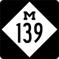
M-139 Southern Terminus: US-12/Pulaski Hwy southwest of Niles (east of US-12 & US-31 interchange)
Northern Terminus: Nbd: BL I-94/E Main St & Martin Luther King Dr; Sbd: BL I-94/E Main St & Fair Ave, in Benton Harbor
Length: 26.520 miles
Map: Route Map of M-139
Notes: It is ironic that M-139 was originally conceived as an easterly bypass of the Benton Harbor/St Joseph area in the late-1920s, yet for much of its history the route was used as an access into the area from the two subsequent bypasses—I-94 in the 1960s and US-31 in the 2000s. Starting in 2010, however, M-139 took over the former route of US-31/US-33 from Berrien Springs into Niles and replaced the western half of the BUS US-12 designation in Niles, drastically increasing its length and useage. With the extensions in the 2000s and 2010s, M-139 still only exists within Berrien County.
  In a city never devoid of state trunkline routing changes, reroutings and alterations, yet another major highway designation took place in March 2010 when MDOT and the City of Niles came to agreement about the four blocks of Main St through the downtown core of the city. Reportedly due to truck traffic using the BUS US-12 route throug downtown Niles and the City's inability to curb such useage, the City began talks with MDOT to take over jurisdiction of the short segment of BUS US-12 between the BUS US-31/Front St (now M-139) and M-51/5th St junctions. Upon viewing a map of the Niles area, one notes this is a rather short segment of trunkline transferred to local control, yet it resulted in a gap in an otherwise complete business routing through town. Coinciding with the extension of M-139 from Berrien Springs southerly to Niles along the former routes of unsigned OLD US-31 and the orphaned BUS US-31 route, MDOT was able to make sufficient routing changes to accommodate the transfer, although some may remark the resulting arrangement of highway routes into and through the city is somewhat "awkward."
  Longtime site visitor/contributor Marc Fannin wrote in with an interesting factoid: Along the portion of M-139 from I-94 southerly to Scottdale which was superceded by the US-31 designation for nearly forty years (c.1964-2003), the physical street name for the addresses for the homes and businesses along that stretch of roadway remained "M-139" even though the route number was US-31 all those years! — Thanks Marc for the info!
  M-139's length from 2003 to 2010 was 11.82 miles prior to being extended to Niles.
History: 1929 (Sept 2) – A new 8.2-mile long state trunkline is established in the Benton Harbor area, generally acting as an easterly bypass of the Benton Harbor-St Joseph area beginning at US-31 at Scottdale and running almost due northerly to a yet-to-be-established shoreline routing of US-31 from St Joseph to Hagar Shores. However, none of the route is yet constructed at this time.
  1931 – M-139 from US-31 at Scottdale northerly to Napier Ave is completed and opened to traffic. Sources indicate this year is the first where M-139 likely appears signed in the field from US-31 at Scottdale northerly to Nickerson Rd, then northwesterly via Nickerson to Ogden Ave northerly via Ogden to Empire Ave, westerly via Empire to Broadway Ave and northerly again via Broadway to Pipestone St, then northwesterly via Pipestone to US-12/US-31/W Main St in downtown Benton Harbor. Official documents, however, indicate the Napier-Nickerson-Ogden-Empire-Broadway-Pipestone route is not an officially established trunkline, rather just a marked-and-maintained routing while the rest of the "official" M-139 is being constructed.
  1933 – M-139 from Napier Ave northerly to Pipestone Rd is completed and opened to traffic and M-139 traffic is now directed northerly from Nickerson Rd via M-139 to Pipestone Rd, then northwesterly via Pipestone to US-12/US-31/W Main St downtown Benton Harbor. As with the previous in-town routing, which was only marked-and-maintained but never assumed into the trunkline system, Pipestone St from M-139 northwesterly into downtown is only marked-and-maintained.
  1935 – A slight realignment to the marked-and-maintained-only route of M-139 in downtown Benton Harbor removes M-139 from Pipestone between Wall & Main Sts. Traffic is now directed easterly via Wall St and northerly via Market St to US-12/US-31/Main St.
  1936 – Late this year, construction is completed on M-139 from Pipestone Rd northerly to Britain Ave where M-139 traffic is then directed northerly via Fair Ave to a new northern terminus at US-12/E Main St. The former route via Pipestone St, Wall St & Market St was never officially assumed as a trunkline and, therefore, remains in local control.
  1954 (Jan 25) – The new direct route of US-31 from downtown St Joseph northeasterly to Paw Paw Ave north of Benton Harbor (via present-day M-63) is officially assumed into the state trunkline system. The former route of US-31 via Paw Paw Ave from the new alignment north of Benton Harbor southerly into downtown is redesignated as M-139, while US-12/E Main St between Paw Paw Ave and M-139/Fair Ave becomes concurrently signed with M-139 to connect the two segments. It is important to note that the portion of M-139 via Paw Paw Ave between Riverside Dr and downtown Benton Harbor runs via a marked-and-maintained-only route, meaning this portion of Paw Paw is not officially assumed into the trunkline system. Rather the State Highway Dept still hopes to construct M-139 on a direct alignment between the north end of Fair Ave and Paw Paw Ave at Riverside Dr.
  1961 (Jan 6) – In conjunction with the completion of the I-94/US-12 freeway bypass of Benton Harbor and St Joseph, M-139 immediately south of the new freeway to the St Joseph River bridge is realigned and the former route, via Old M-139, is turned back to local control.
  1963 – The first segment of the I-96/US-31 freeway is completed from I-94 at Exit 34 northerly to the Hagar Shores area in northern Berrien Co. US-31 is rerouted beginning at Scottdale to run northerly with M-139 from US-31/US-33 to the new I-94 freeway, then northeasterly via I-94 to I-96 (present-day I-196), then northerly via I-96 to Hagar Shores.
  1964–65 – At some point in late-1964 or early-1965, M-139 is truncated at the I-94 & US-31 interchange south of Benton Harbor. The formerly-concurrent US-31/M-139 from there southerly to Scottdale becomes just US-31.
  1969 (Aug 26) – All of M-139, both the marked-and-maintained portion via Paw Paw Ave from BL I-94/Main St in Benton Harbor northerly to Riverside Dr and the official trunkline portion of Paw Paw Ave from Riverside northerly to US-33 (present-day M-63), is removed from the state trunkline system. In addition, the never-built portion of M-139 from the north end of Fair Ave northerly to the cnr of Paw Paw Ave & Riverside Dr is also cancelled.
  1973 (Sept 14) – A new 0.993-mile long state trunkline routing is established from M-139 just north of Empire Ave northerly on new alignment to Highland Ave, then northerly via Pine St to BL I-94/E Main St. This new route becomes the northbound side of M-139 (Martin Luther King Jr Dr), while the existing M-139 via Fair Ave from BL I-94/E Main St southerly to the intersection with the new trunkline routing becomes the southbound only lanes.
  2003 (Aug 27) – A 9.1-mile extension of the US-31 freeway in Berrien Co is opened to traffic, connecting the northern end of the existing freeway at Berrien Springs with Napier Ave east of Benton Harbor. This is the fourth of five informal "phases" of the freeway in Berrien Co and it removes through traffic off the rather dangerous former route of US-31 between Berrien Springs and I-94. The former route of US-31 between the freeway at Berrien Springs (at Exit 15) and I-94 south of Benton Harbor/St Joseph is redesignated as an extension of M-139, instead of an extension of M-63 as had been originally proposed and confirmed by several MDOT documents.
  2010 (Mar 10) – While the extension of M-139 from its southern terminus at the US-31 freeway at Berrien Springs to downtown Niles was already being planned, a new development in downtown Niles resulted in the transfer of four blocks of the BUS US-12 route beginning at the BUS US-31 (soon-to-be M-139) to city control. As MDOT would not allow for a gap in the existing route of BUS US-12, the M-139 designation is now further extended southwesterly from downtown Niles, supplanting the western half of the former BUS US-12 route. M-139 now terminates at US-12 southwest of Niles.
Freeway/Expwy: No portion of M-139 is freeway or expressway.
NHS: Entire route.
Photographs:
Weblinks: M-139 @ Michigan Highway Ends – photos of the termini of M-139 at Dan Garnell's archived Michigan Highway Ends website.
  Niles Area Highways: 2010– Map – An overview map of the Niles area showing the current state of the various highway routings in and around that city.
  Michiana Roads – part of Marc Fannin's Roadfan.com website dedicated to the area of Southwest Michigan and Northern Indiana known by many as "Michiana."


M-120 | M-121 | Former M-122 | M-123 | M-124 | M-125 | Former M-126 | US-127 | M-129 | Former M-130 | US-131 | M-134 | M-136 | Former M-137 | M-138 | M-139 | Jump to Bottom


Home | Jump to Highway Listings:

  1-9
  10-19
  20-29
  30-39

  40-49
  50-59
  60-69
  70-79

  80-89
  90-99
  100-119
  120-139

  140-159
  160-179
  180-199
  200-229

  230-249
  250-696
  Bus 2-31
  Bus 32-94

  Bus 96-496
  A-2—C-81
  D-19—H-15
  H-16—H-63