| Southern Terminus: |
Cnr Southfield Rd & Lafayette Blvd in Lincoln Park, one block southeast of jct I-75/Fisher Frwy & M-39 and two blocks northwest of M-85/Fort St |
| Northern Terminus: |
M-10/John C Lodge Frwy in Southfield |
| Length: |
16.383 miles |
| Maps: |
Route Map of M-39 |
| Notes: |
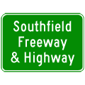
The entire length of M-39 is known as Southfield Frwy, Southfield Rd or Southfield Hwy. |
| |
While there have been three different "iterations" of M-39 over the history of the state trunkline highway system in Michigan, the last two have been somewhat related. The first M-39 was a trunkline in mid-west Michigan, while the second and third iterations were both in Metro Detroit. The second M-39 ran along Schaefer Hwy between US-16/Grand River Ave (present-day M-5 and US-25/Dix Hwy, while the third routing is the present-day M-39. |
| |
In "State Trunkline Needs, 1960–1980," a set of maps prepared by the State Highway Dept's Office of Planning, Programming Division in 1960 showing possible additions, upgrades and improvements to the state trunkline system over the ensuing twenty years, MSHD staff recommended one major change to the route of M-39 during that timeframe, including:
- Turning back the former route of M-39 along Schaefer Hwy to local control and transferring the M-39 route designation onto the Southfield Fwy/Southfield Hwy aligment. Interestingly, it seems this change had already taken place the previous year, although it was still illustrated on the maps. As such, this proposal obviously was implemented.
|
| History: |
1920s – In the early 1920s, the first incarnation of M-39 in Michigan is a route from Grand Rapids to Lansing, competing with M-16 between the same two towns. From Grand Rapids, M-39 runs easterly concurrently with M-16 along E Fulton St and Cascade Rd. After M-16 splits off to run toward Ada and Lowell, M-39 continues southeasterly via Cascade Rd (later to become US-16/M-50) through Cascade and Whitneyville. M-39 then turns southerly via present-day Alden Nash Ave near Alto and follows present-day M-50 southerly and easterly through Lake Odessa to Woodbury. From there, M-39 continues easterly through Sunfield and Mulliken to Grand Ledge via present-day M-43. At Grand Ledge, M-39 again meets up with M-16 and the two routes make the 10½-mile trip into downtown Lansing via Saginaw Hwy together. |
| |
c.1925 – M-16 (soon to become US-16) is realigned at either end of M-39. Out of Grand Rapids, M-16 is rerouted onto and replacing the M-39 designation through Cascade, Whitneyville to Alto. From there M-16 heads due easterly on its new alignment toward Portland. From this new routing of M-16 (soon US-16) near Alto, M-39 continues southerly and easterly via its existing routing. From Lansing, M-16 is realigned to run northwesterly out of town along Grand River Ave, ending the concurrency with M-39 between Grand Ledge and Lansing, with M-39 running into Lansing alone on Saginaw Hwy. |
| |
1928 – By 1928, M-50 replaces all of M-39 between US-16 near Alto and present day jct of M-43/Grand Ledge Hwy & Ionia Rd, two miles east of Woodbury in northwestern Ionia Co, with M-50 continuing southerly from that point toward Vermontville. M-39 maintains its route through Sunfield, Mulliken and Grand Ledge. Also, in Lansing, M-39 is routed from its eastern terminus (cnr Saginaw St & Larch St) southerly via US-27/M-78/Larch St to Michigan Ave, then easterly via Michigan Ave to end at US-16/Grand River Ave in downtown East Lansing. |
| |
c.1930 – By 1930, M-39's western terminus is moved easterly and the route is scaled back by 10 miles when M-50 is realigned to travel first easterly along M-39's former route to present-day Cochran Rd, then due southerly into Charlotte. M-39 is now only 19 miles long. |
| |
1934 – The see-saw effect of M-39's western terminus continues with a realignment of M-50 onto a direct route between Woodbury and Charlotte along the Clinton Trail. M-39 is extended westerly along is pre-1930 route (present day M-43/Grand Ledge Hwy) to end at M-50 one mile east of Woodbury. M-39 is now 30 miles long. |
| |
1938 (Early) – The entire route of M-39 from Woodbury to downtown East Lansing is redesignated as an easterly extension of M-43, signalling the end of the first incarnation of M-39 in Michigan. |
| |
1939 (Spring) – The second interation of M-39 in Michigan begins when M-3/Schaefer Hwy is redesignated M-39. This version of M-39 begins at US-25/Dix Hwy in Melvindale, heads northerly via Schaefer Hwy, ending at US-16/Grand River Ave in western Detroit. The State Highway Department is removing all single-digit state highway designations from the system in preparation for their use on a statewide system of "superhighways." |
| |
1957 (June 24)  – The State Highway Dept approves what is being termed a 13-mile extension of the Detroit-Toledo Expwy (which is currently proposed to end at US-12/Detroit Industrial Expwy west of Southfield Rd) to run from the US-12/Detroit Industrial Expwy northerly along existing Southfield Rd for 13 miles to a northern terminus at Nine Mile Rd & Northwestern Hwy in Southfield Twp in Oakland Co. Construction of the $70.4 million freeway is set to begin in the spring of 1958 and be completed in 1961. – The State Highway Dept approves what is being termed a 13-mile extension of the Detroit-Toledo Expwy (which is currently proposed to end at US-12/Detroit Industrial Expwy west of Southfield Rd) to run from the US-12/Detroit Industrial Expwy northerly along existing Southfield Rd for 13 miles to a northern terminus at Nine Mile Rd & Northwestern Hwy in Southfield Twp in Oakland Co. Construction of the $70.4 million freeway is set to begin in the spring of 1958 and be completed in 1961. |
| |
1959 – The entire M-39 designation is removed wholesale from Schaefer Hwy, moved west two miles, and added to Southfield Rd between I-94/US-12/Detroit Industrial Expwy in Allen Park and Northwestern Hwy (present-day John C Lodge Frwy) in Southfield. In 1959, Northwestern Hwy is not yet a state highway. M-39/Southfield Rd between I-94/US-12 and Seven Mile Rd is a divided highway and undivided north of Seven Mile. |
| |
1961 – Three changes to M-39 this year, including new freeway segments:
- On Dec 19, the first of two freeway segments to open to traffic runs 3 miles from near Gildow St (present-day Hubbard Dr) in Dearborn to W Chicago Blvd just north of Joy Rd in Detroit.
This segment alone cost $8 million to construct.
- The second freeway segment to open runs ½ mile in the City of Detroit, ¼ mile on either side of the Plymouth Rd interchange.
- Additionally, the M-39 designation is extended southerly from I-94 (itself now sans US-12) via Southfield Rd to US-25/Toledo-Dix Hwy.
|
| |
1962 – A segment of the M-39/Southfield Frwy is completed between I-94 /Detroit Industrial Frwy and Outer Dr in Allen Park. In addition, the ½-mile gap in freeway at W Chicago is completed. |
| |
1962 (Dec 27, 11:00 am) – Approximately 2½ miles of the M-39/Southfield Frwy is completed and opened to traffic from Glendale Ave (just south of Schoolcraft Rd) northerly to McNichols (6 Mile) Rd in Detroit. This segment cost $6.7 million to construct. |
| |
1964 (Jan 6–15) – The segment of M-39/Southfield Frwy from McNichols (6 Mile) Rd northerly to M-102/8 Mile Rd in Detroit is completed and opened to traffic on Jan 6. Two days later on Jan 8, the portion of the freeway from W Chicago Blvd northerly to Glendale Ave in Detroit is then opened to traffic. One week later on Jan 15, the third new segment of the M-39/Southfield Frwy is opened to traffic in Dearborn from Rotunda Dr northerly to near Gildow St (present-day Hubbard Dr). |
| |
1964 (Aug 11, 10:00am) – A 1.7-mile section of the M-39/Southfield Frwy is completed and opened to traffic in Dearborn between Outer Dr and Rotunda Dr. This segment cost $4.4 million to construct. |
| |
1964 (Oct 29) – The last mile of the M-39/Southfield Frwy is completed in the City of Southfield from the northern end of the completed freeway at M-102/8 Mile Rd to an interchange at 9 Mile Rd and the BS I-696/Northwestern Hwy freeway (present-day M-10/John C Lodge Frwy) which also opens to traffic between Greenfield Rd and 9½ Mile Rd today. |
| |
1966 – With the completion of I-75 northerly through Allen Park and Melvindale, M-39 is extended southeasterly via Southfield Rd to end at M-85/Fort St beyond the new freeway. The temporary designation of "TO I-75" is also added to M-39 from I-75 north to M-102/Eight Mile Rd. |
| |
1969 – The above noted TO I-75 designation is removed from M-39 and M-102 in the Detroit area with the completion of the I-75 through the city. |
| |
1974–77 – The large I-96/Jeffries Frwy interchange is constructed. I-96 opens east of M-39 in 1975 and west in 1977. |
| |
c.1988 – At some point in the late-1980s, the M-39 designation is scaled back by two blocks when the City of Lincoln Park expresses interest in adding parking to the center of the roadway. As this is not up to state trunkline specifications, MDOT hands the southernmost two blocks of the road back to local authorities. The Official 1988 Michigan Transportation Map is the first to show this change. However, it will take MDOT about a decade to remove all M-39 route markers from this short two-block stretch. |
| Controlled Access: |
Freeway: Pinecrest Dr just south of the I-94/Detroit Industrial Expwy interchange in Allen Park northerly to M-10/John C Lodge Frwy in Southfield. (14.2 miles) |
| NHS: |
The entire length of M-39 is on the National Highway System (NHS). |
| Memorial Highway: |
At present, no portion of M-39 has been designated as part of a Memorial Highway. |
| Photographs: |
|
| Weblinks: |
|