| M-101 is a former state trunkline route existing from c.1927 until November 7, 1939. |
| Southern Terminus*: |
Intersection of Main St & the Detroit & Mackinac Railway (present-day North Eastern State Trail) in downtown Millersburg. |
| Northern Terminus*: |
US-23 (present-day M-68) at cnr present-day Millersburg Rd & Tonkey Hwy, 1½ miles north of downtown Millersburg |
| Final Length*: |
1.5 miles |
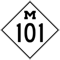
| Maps: |
 Route Map of Former M-101 Route Map of Former M-101 |
| Notes: |
*The termini and final length for M-101 reflect the beginning and ending of the route and its length as of the time of its decommissioning in late 1939. |
| |
M-101 was a short trunkline spur route connecting downtown Millersburg in Presque Isle Co with US-23 (present-day M-68) north of the village. |
| History: |
1915 (June 18) – As originally established, the route of T.L. 10 (Trunk Line 10)—the original East Michigan Pike route up the east side of the state (predecessor of US-23 and, in central Presque Isle Co, M-68)—proceeded southerly from the Ocqueoc Falls area toward Millsburg along Millersburg Rd. In the village, T.L. 10 continued southerly via Main St, then westerly along Chandler St, northerly one block on Gardner St, then westerly via Walker Hwy, northerly on Ocqueoc Hwy, westerly along Dempsey Hwy, northerly again via Schnepp Rd, then westerly along the present-day route of M-68 toward Onaway. |
| |
1919 (Sept 30) – All of M-10 within Case Twp and the Village of Millersburg—from Orcutt Hwy southerly to Millersburg (the portion within the Village of Millersburg was not officially established as a trunkline route, although was signed as part of M-10), then along the stairstep route northwesterly back to the present-day route of M-68—is cancelled as a state trunkline highway route. Simultaneously, the segment of Millersburg Rd from Orcutt Hwy southerly into Millersburg to the Detroit & Mackinac Ry is re-established as a state trunkline route (now officially adding the portion of Main St into downtown Millersburg), while a new, more direct route for M-10 from Onaway and points west is established following the present-day route of M-68 to Millersburg Rd. This results in an odd three-legged trunkline with M-10 heading northerly and westerly from the Millersburg Rd & Tonkey Hwy intersection (similar to how M-68 does today), with the 1½ mile long spur route into downtown Millersburg heading to the south from that same intersection. It is unclear how this Millersburg spur route is signed at this time, if it is, indeed, posted as a state trunkline route at all. |
| |
1927 – Similar to the history of M-100, the route of M-101 at Millersburg is not designated on official State Highway Dept maps as such until 1927. To date, no reference to "M-101" can be found prior to 1927. If it was not posted prior to this, M-101 is now likely signed as such in the field. |
| |
1939 (Nov 7) – In a spate of similar turnbacks, the M-101 spur route into Millersville from US-23 (soon to be redesignated as M-68) is cancelled as a state trunkline route and transferred from state to county (north of Big Cut Hwy) and municipal (south of Big Cut Hwy) control. M-101 ceases to be a state trunkline designation and has not been used since. |
| Controlled Access: |
No portion of M-101 upon decommissioning existed as freeway or expressway. |
| Photographs: |
|
| Weblinks: |
|
| |
|