

Intercounty Highways: The Ogemaw Routes
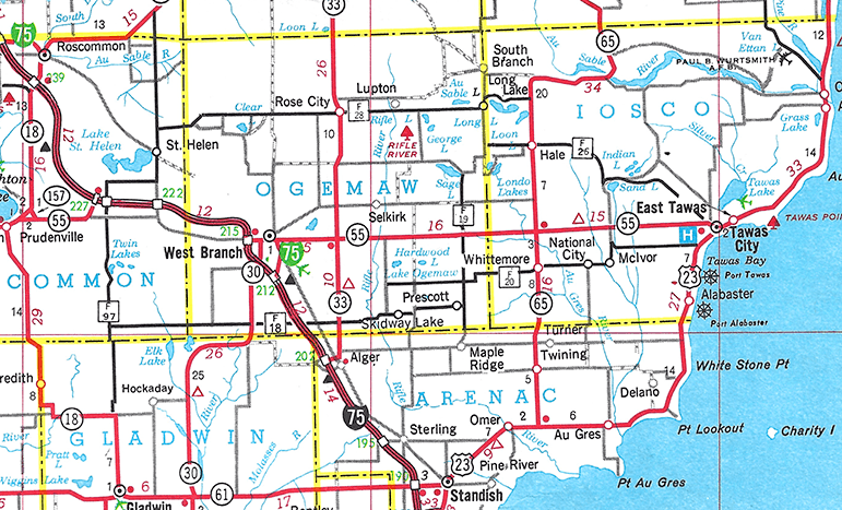
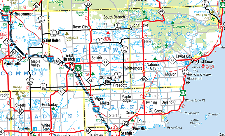
Several years into the Intercounty Highway program, Ogemaw and Iosco Counties added four new routes, three spanning both counties in an east-west direction—F-20, F-26 and F-28—and one running north-south in eastern Ogemaw—F-19. A few years later, a fifth east-west route was added in Ogemaw: F-18. As expected, each of these new routes was added to Official Michigan Transportation Map published by MDOT. While nothing was overly odd at this point, from their appearances on the map, some of the newly-added routes' termini were somewhat non-standard. For example, F-26, as depicted on the official state map, began in Tawas City, proceeded northwesterly then westerly through Hale and simply terminated on the Iosco/Ogemaw Co line, while F-19 began at the Arenac/Ogemaw Co line, ran northerly past Prescott, terminating at an unnumbered county road near Sage Lake. Also, F-20 running westerly through the Iosco Co communities of McIvor, National City and Whittemore and into Ogemaw Co, similarly terminted at an unnumbered county road north of Skidway Lake. Generally, Intercounty Highway routes begin and end at a freeway interchange, a state trunkline highway, another Intercounty route, or some other destination, not a random county roadway or at a county line.
Even more odd was that five additional similarly-designated Intercounty-esque routes were also added to the official Ogemaw Co road map by the Ogemaw Co Road Commission which were not added to the official state map by MDOT and seemingly never signed in the field by the Road Commission either. These routes—F-7, F-9, F-17, F-21 and F-24—are enigmas in the cannon of the Intercounty Routes in Michigan transportation history. Very little is known about these "phantom" routes, however they remained depicted on Ogemaw County-issued maps for decades to come. As they were assumedly never signed in the field with the same yellow-on-blue Intercounty Highway pentagon route markers, these additional routes are not treated as being part of the Michigan Intercounty Route System at this point.
And Then They Were Gone
Then, further adding to the mystery, all the Ogemaw Co Intercounty routes and every one of the Intercounty routes in Iosco Co (with the exception of F-41) were suddenly removed by MDOT from the 1985 edition of the Official Michigan Transportation Map. No explanation has been uncovered to date for this abrupt and major change. While Iosco Co seemed to have completely removed the Intercounty route markers from its segments of F-20 and F-26, other than Ogemaw Co's portion of F-20—if it was ever, indeed, signed at all—the remaining Ogemaw Co Intercounty highways have remained signed ever since the 1980s! Not well-signed, of course, matching much of the rest of the Intercounty Highway system in Michigan, but signed nonetheless. Oddly, MDOT also removed the portion of F-18 and F-28 extending into Roscommon Co as well for the 1985 map, even though Roscommon, like Ogemaw, never removed any of the route markers from their portions of those two routes either!
And Back! Sort Of...
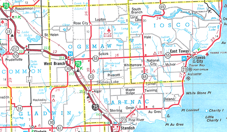
In 2004, a year after Michigan's official transportation map was finally digitized, MDOT re-added just the Roscommon Co portions of F-18 and F-28 as "stub routes" for some reason, even though they had been continuously signed for the previous twenty years and also remained signed in neighboring Ogemaw Co as well. The official map now depicted the two Intercounty routes as terminating at the Roscommon/Ogemaw Co line, which was incorrect. Three years later, after hearing their own department had been posting F-18 junction and directional signage along M-30 south of West Branch in Ogemaw Co for decades, MDOT extended F-18 on the official map easterly to M-30 as well. Three more years later, the F-18 symbol on the official state map was extended easterly to M-33, although F-18 was signed all the way to Prescott and had been since the late 1970s.
But Why?
Why MDOT has long refused to depict the signed Intercounty routes in Ogemaw Co on its maps remains unclear at present. Each of the routes was thoroughly field-checked most recently in 2023 and F-18, F-19, F-26 and F-28—all but one of those shown on the official maps from 1979 to 1984—still remain signed, for the most part, in Ogemaw Co. For this reason, those Intercounty routes are all featured with current route listings on this site, even if MDOT may not consider them as "officially" sanctioned in their book.
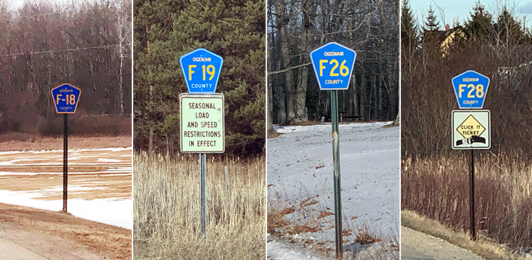
Ogemaw County Intercounty Highway route markers, as posted along highways in Ogemaw County in February 2023. Photo ©2023
Christopher J. Bessert, All Rights Reserved.
Ogemaw County Intercounty Highway routes as mapped by Christopher J. Bessert.
©2023
Christopher J. Bessert, All Rights Reserved. Do not copy without prior permission.
As any new information on these routes becomes available, it will be included here. If anyone has any info, please don't hesitate to send it along to the webmaster!
Additional Information
- The Ogemaw Routes maps
- The Ogemaw Routes Listings:
- Intercounty Highways
- Intercounty Route Listings: