

| Back to Previous Route: M-5 |
  |
On to Next Route: Former M-7 |
| Western Terminus: | I-196/Gerald R Ford Frwy at Exit 64 in Ottawa County's Georgetown Twp, between Hudsonville and Grandville. |
| Eastern Terminus: | I-96 at Exit 46 near Cascade southeast of Grand Rapids, at the Thornapple River. |
| Length: | 19.696 miles |
| Map: | Route Map of M-6 |
| Notes: | The Grand Rapids South Beltline is a freeway bypass connecting I-96 southeast of Grand Rapids to US-131 in the Cutlerville area then over to I-196/Gerald R Ford Frwy in Georgetown Twp. With the 1997 hike in the state gas tax, funding was approved for commencement of construction, which began in November 1997. The 20-mile-long project was projected to cost $700 million, but came in approximately $50 million under budget. The construction of the South Beltline was separated into three phases: Phase I from I-96 to M-37 (2002), Phase II from M-37 to US-131 (2008), and Phase III from US-131 to I-196 (2008). Phase I was completed six months ahead of schedule, while completion of Phases II and III were moved up from 2008 to 2005 due to a more expedited construction schedule. In the end, due to a string of good weather and other factors, Phases II & III were opened to the public on November 17, 2004, more than a half year ahead of schedule. View the MDOT Press Release and the author's photographs from the opening of Phases II & III of the South Beltline. |
| While the South Beltline would be an excellent candidate for a three-digit Interstate designation, such as I-296, sources indicate no such designation is being persued at this time. | |
| The first five miles of the M-6/South Beltline Frwy, or Phase I, was opened to traffic on November 21, 2001, approximately six months ahead of schedule. The portion of the freeway opened connects the "Y"-interchange on I-96 at the Thornapple River crossing with M-37/Broadmoor Ave in northeastern Gaines Twp. All westbound M-6 traffic was forced to exit the freeway at M-37 from that time until the rest of the freeway opened in November 2004. View the MDOT Press Release from the opening of Phase I of the South Beltline. | |
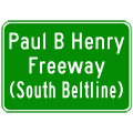
| On June 2, 1998, the Michigan Legislature voted to name the South Beltline after Paul B. Henry, former West Michigan state and federal legislator, who died in 1993. According to an MDOT press release, "Paul B. Henry of Grand Rapids served with distinction in the Michigan House of Representatives, Michigan Senate and U.S. House of Representatives between 1979 and 1993. His public service career spanned three decades, beginning with the Peace Corps in 1963. It would end 30 years later with his untimely death in 1993." After that time, MDOT has seeminlgy setting on using the name "Paul B Henry Freeway" in many of their publications concerning the South Beltline. On July 16, 1999, MDOT unveiled large green signs along routes intersecting the new South Beltline (at I-96 east of Cascade, M-37/Broadmoor Ave south of Kentwood, US-131 at Cutlerville, and I-196 east of Hudsonville) complete with the "Paul B Henry Freeway" name. The Grand Rapids Press stated the legislation to name the new freeway after Henry was sponsored by Rep. William Byl in the House and by Sen. Glenn Steil in the Senate. Regardless of the new name, locals will likely continue to refer to the route as the "South Beltline" for many years to come. | |
The Michigan Dept of Transportation created two handy brochures: one which contains an overview of the M-6/South Belfline project, including a map showing the location of the new freeway and the various on- and off-ramps at each interchange, the other a commemorative history of the South Beltine for the ribbon cutting ceremony in 2004:
|
|
| Several site visitors have written asking if 11 Mile Rd in Macomb Co was designated M-6 prior to the completion of the I-696/Walter P Reuther Frwy between I-75 and I-94 in the mid-1970s. At that time, the only source available which showed an M-6 running along 11 Mile Rd was the AAA road map of Michigan from that time period—it never appeared on any of the Official highway maps of Michigan. It seemed doubtful that the M-6 on the AAA map was anything but a simple cartographic error. This is until Mike Austerman wrote in with the following: When construction of phase II of I-696 was going on (between I-94 and I-75, primarily in Macomb county) during the 1970's, the service drive was designated as M-6. Throughout much of Macomb county, I-696 lies directly on what was 11 Mile Rd. Today, the service drive is known as 11 Mile Rd. I remember riding my bicycle on the new concrete on yet-to-be opened freeway- and the road signs with M-6 on them. As soon as 696 opened to traffic, the M-6 signs were gone. They never used them for phase III - between I-75 and the 'Mixing Bowl' (then US-10, US-24, and M-4). Another site visitor, Phil Singer, wrote in to add that he recalls travelling down the 10 Mile Rd portion of the present I-696 service drives on the Oakland Co side of Dequindre Rd and those drives were also signed as M-6. Mike & Phil's recollections indicate the entire service drive system for the second phase of I-696 from I-75 easterly to I-94 was designated as M-6 until the freeway was completed and opened to traffic. —Many thanks to both Mike & Phil for the information! |
|
| In addition to the two 'iterations' of M-6 detailed above, an even earlier routing of M-6 existed in the Keweenaw Peninsula in the 1920s and 30s. See the "History" notes below for more informaiton on this routing. | |
| In "State Trunkline Needs, 1960–1980," a set of maps prepared by the State Highway Dept's Office of Planning, Programming Division in 1960 showing possible additions, upgrades and improvements to the state trunkline system over the ensuing twenty years, MSHD staff recommended countless upgrades, realignments and new freeway corridors across the state, many of which were extremely ambitious in nature. Interestingly, however, there was no M-6/South Beltline corridor among these proposals. They did included, though, a complete freeway-ization of M-21 from Grand Rapids east to Port Huron via Ionia, St Johns, Owosso and Flint, and an M-37 freeway running from Walker northerly to Casnovia. | |
| History: | 1926 – A short, two-mile long highway leading from US-41 at Phoenix in Keweenaw Co to Eagle River is designated as M-6, although the 1927 Rand McNally "Auto Road Map of Michigan" lables the route as M-9—it is assumed this is an error as other, more official sources all indicate this route to be numbered M-6. |
| 1939 – In mid-1939, the entire two-mile length of M-6 between Phoenix and Eagle River is re-designated as M-111 when all single-digit highway designations are removed and purportedly banked for future use along a proposed "superhighway" system. This marks the beginning of a more than 30-year absence of M-6 from the state highway system. | |
| 1970s – As noted above, the M-6 designation is applied to the newly constructed service drives for the yet-to-be-completed I-696/Walter P Reuther Frwy in southern Macomb and southeastern Oakland Counties. It is unclear, though, how well-signed M-6 was on intersecting state highways as well as on I-94. As Mike Austerman noted above, once I-696 was completed, the M-6 designation disappeared. | |
| 1972 (Feb 24) – As part of a compromise to gain passage of his $83-million gasoline tax, roadbuilding and mass-transit financing package, Governor Milliken allows a House amendment to the bill designating a "South Kent County Connector" freeway to span between I-96 at Cascade and I-196 near Hudsonville. | |
| 1995 – After being discussed and bandied about since the mid-1950s, imminent construction work the South Beltline project is announced, however a route designation was not yet assigned to the new freeway. | |
| 1997 – The route designation for the new South Beltline Frwy is announced as M-6. | |
| 1997 (Nov 14) – Construction begins on the South Beltline project with the ceremonial turning of the first shovel of dirt along Phase I: I-96 to M-37/Broadmoor Ave. At the outset of the project, Phase I is scheduled for completion in 2002. | |
| 1998 – On June 2, the Michigan Legislature names the South Beltline after Paul B. Henry, former West Michigan congressman. By year's end, the twin South Beltline overpasses spanning M-37/Broadmoor Ave are complete. | |
| 1999 – The eastbound M-6/South Beltline ramp to eastbound I-96, spanning the Thornapple River, is completed. It is the only one of the four ramps to have construction begun—or completed in this case—during 1999. | |
| 2001 (Nov 21) – The first five miles of the M-6/South Beltline Frwy are opened to traffic with a ribbon-cutting ceremony near the I-96 interchange at 10:30 am. Until Phases II and III are completed, signage along I-96 at Exit 46 reads "M-6 TO M-37." | |
| 2004 (Nov 17) – The remainder of the M-6/South Beltline (Paul B Henry) Frwy is opened to traffic. A ribbon-cutting ceremony is held at the Byron Center Ave interchange at 10:00 am and the first traffic starts flowing at 12:15 pm with all ramps and lanes completely open by 1:30 pm. While motorists may now travel from I-96 on the east to I-196 on the west, one ramp at the western end of the freeway at I-196 does not open to traffic, due to flaws found in the bridges carrying that ramp over I-196 and westbound M-6 in 2002. A commemorative brochure is distributed at the ribbon-cutting ceremony: M-6 The Paul B. Henry Freeway: A Commemorative History of M-6. | |
| Controlled-Access: | The entire route of M-6 is a freeway. |
| NHS: | The entire length of M-6 is part of the National Highway System (NHS). |
| Memorial Highways: | The following Memorial Highway designations have been officially assigned to parts of M-6 by the Michigan Legislature:
|
| Photographs: |
|
| Weblinks: |
|
| Back to M-5 | Route Listings Home | On to Former M-7 |