Back to Previous Route:
M-104 |
 |
On to Next Route:
M-106
|
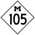
| M-105 is a former state trunkline route existing from March 9, 1928 until July 13, 1939. |
| Southern Terminus*: |
M-53/Van Dyke Rd at the hamlet of Popple, six miles southwest of downtown Bad Axe |
| Northern Terminus*: |
M-83/Pigeon Rd (present-day M-142) at cnr of Grassmere Rd, 3 miles east of downtown Elkton in central Huron Co |
| Final Length*: |
4.953 miles |
| Maps: |
Route Map of Former M-105 |
| Notes: |
* The termini and final length for M-105 reflect the beginning and ending of the route and its length as of the time of its decommissioning in mid 1939. |
| |
M-105 was a short cut-off route between M-53 southwest of Bad Axe and what is now M-142 (which was designated M-29 when M-105 was first established in 1928 and later designated M-83 as of the retirement of M-105 in 1939) in central Huron Co. For its entire existence, M-105 never bore a hard surface. |
| History: |
1928 (Mar 9) – The 5.0 miles of Popple Rd from M-53/Van Dyke Rd westerly one mile to Grassmere Rd and Grassmere from Popple northerly to M-83/Pigeon Rd (present-day M-142) are transferred back to state jurisdiction, after having been previous part of the route of M-53 from 1920–23. This new route is designated M-105. |
| |
1939 (July 13) – In a spate of similar turnbacks, the entire route of M-105 is transferred from state back to county control. M-105 ceases to be a state trunkline designation and has not been used since. |
| Controlled Access: |
No portion of M-105 upon decommissioning existed as freeway or expressway. |
| Photographs: |
|
| Weblinks: |
|
| |
|

