| Southern Terminus: |
M-44 just west of Belding (cnr Storey Rd & Belding Rd) |
| Northern Terminus: |
M-46 at Lakeview
(cnr Greenville Rd & Howard City–Edmore Rd) |
| Length: |
24.395 miles |
| Maps: |
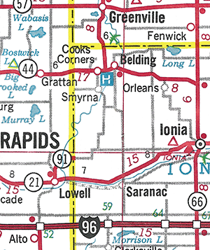
Route Map of M-91 |
| Notes: |
 M-91 is a moderately short (just shy of 25 miles in length), secondary state trunkline route which runs north-south through the western half of Montcalm Co and into the northwest corner of Ionia Co, serving to connect the communities of Lakeview, Greenville and Belding. The current iteration of M-91 dates back to 1942 and formerly extended south of Belding running in a stair-step fashion as a minor trunkline route to Lowell in eastern Kent Co, then southerly to US-16 (later I-96) near Alto. The southernmost portion of the route was gradually turned back to local control between 1968 and 1986, leaving the portion we have today. M-91 is a moderately short (just shy of 25 miles in length), secondary state trunkline route which runs north-south through the western half of Montcalm Co and into the northwest corner of Ionia Co, serving to connect the communities of Lakeview, Greenville and Belding. The current iteration of M-91 dates back to 1942 and formerly extended south of Belding running in a stair-step fashion as a minor trunkline route to Lowell in eastern Kent Co, then southerly to US-16 (later I-96) near Alto. The southernmost portion of the route was gradually turned back to local control between 1968 and 1986, leaving the portion we have today. |
| |
Present-day M-91 was once the southernmost portion of M-66 which,
when it met M-46 in Montcalm Co, jogged
west instead of east as it does today and travelled via Greenville and Belding
to its terminus at Lowell. When M-66 was
relocated to its present routing via Stanton and Ionia in 1942, the modern day version
of M-91 was created. |
| |
 In 1961, the State Highway Dept began studying the idea of realigning M-91 to run more directly to the south in western Ionia Co instead of curving westerly into Kent Co and Lowell. John C Mackie, State Highway Commissioner, proposed the new highway which would include a new bridge spanning the Grand River between Lowell and Saranac, then linking into Hastings Rd and continuing southerly to M-43 approximately five miles north of Hastings. This plan was shelved by the department in early 1963 stating traffic volumes in the area didn't warrant its inclusion on project lists. The focus then turned to realigning the portion of M-91 between Lowell and the new I-96 interchange at M-50/Alden Nash Ave southwest of Lowell to remove it from the narrow and winding route along Segwun Ave as well as the 1¼-mile east-west segment of Grand River Ave (formerly US-16) between Segwun and Alden Nash. This plan involved replacing the old, one-lane Grand River bridge at Lowell (dating from 1884) with a new span ½ mile west, then continuing southwesterly via a widened and partially-realigned Guilford Ave before turning southerly to hook into Alden Nash Ave and southerly to the interchange with I-96. City of Lowell leaders, however, strongly opposed a new span that far west and requested the State Highway Dept build the new bridge adjacent to the existing span and then turn southwesterly to Alden Nash Ave at 36th St and then southerly to the freeway. It was at this point the Kent Co Road Commission stated its willingness to take over jurisdiction of M-91 between Lowell and I-96, once the new bridge and modern realignment was completed by the State. And since state transportation officials stated money for the bridge replacement could be far in the future unless that portion of M-91 was able to be abandoned as a trunkline route and turned back to local control, to which the City of Lowell was receptive. Interestingly, in July 1964, the State Transportation Commission approved the abandonment of M-91 south of Belding and then almost exactly 11 years later in June 1975, the State Administrative Board similarly approved the removal of all of M-91 south of M-44. While the Lowell-to-I-96 segment was turned back to local control in 1968, one year after the Grand River bridge was completed by the state, it wouldn't be until the mid-1980s that the entirety of M-91 south of M-44 at Belding would be cancelled as a trunkline route. In 1961, the State Highway Dept began studying the idea of realigning M-91 to run more directly to the south in western Ionia Co instead of curving westerly into Kent Co and Lowell. John C Mackie, State Highway Commissioner, proposed the new highway which would include a new bridge spanning the Grand River between Lowell and Saranac, then linking into Hastings Rd and continuing southerly to M-43 approximately five miles north of Hastings. This plan was shelved by the department in early 1963 stating traffic volumes in the area didn't warrant its inclusion on project lists. The focus then turned to realigning the portion of M-91 between Lowell and the new I-96 interchange at M-50/Alden Nash Ave southwest of Lowell to remove it from the narrow and winding route along Segwun Ave as well as the 1¼-mile east-west segment of Grand River Ave (formerly US-16) between Segwun and Alden Nash. This plan involved replacing the old, one-lane Grand River bridge at Lowell (dating from 1884) with a new span ½ mile west, then continuing southwesterly via a widened and partially-realigned Guilford Ave before turning southerly to hook into Alden Nash Ave and southerly to the interchange with I-96. City of Lowell leaders, however, strongly opposed a new span that far west and requested the State Highway Dept build the new bridge adjacent to the existing span and then turn southwesterly to Alden Nash Ave at 36th St and then southerly to the freeway. It was at this point the Kent Co Road Commission stated its willingness to take over jurisdiction of M-91 between Lowell and I-96, once the new bridge and modern realignment was completed by the State. And since state transportation officials stated money for the bridge replacement could be far in the future unless that portion of M-91 was able to be abandoned as a trunkline route and turned back to local control, to which the City of Lowell was receptive. Interestingly, in July 1964, the State Transportation Commission approved the abandonment of M-91 south of Belding and then almost exactly 11 years later in June 1975, the State Administrative Board similarly approved the removal of all of M-91 south of M-44. While the Lowell-to-I-96 segment was turned back to local control in 1968, one year after the Grand River bridge was completed by the state, it wouldn't be until the mid-1980s that the entirety of M-91 south of M-44 at Belding would be cancelled as a trunkline route. |
| |
 One oddity created by the varying dates that portions of M-91 between Belding and Lowell were cancelled and transferred to local control was the existence of a disconnected portion of the route being depicted on the official state transportation map for four years in the early 1980s. This runs contrary to longstanding Dept of State Highways and MDOT practice of only showing signed trunklines on the map and using the county road symbology for unsigned state highway routes. Firstly, the remainder of M-91 within the City of Lowell from M-21/Main St downtown to the north city limit was cancelled and turned back to local control in 1973, although it can be assumed it continued to be signed as a "marked-and-maintained" route as it remained on the official state maps after that time. After the Ionia Co portion of M-91 south of Belding was turned back to county control in 1979, though MDOT continued to show the Kent Co portion of the route on the official maps from 1980 through 1984 as an isolated, discontinuous segment until the portion from the Ionia Co line to the Lowell north city limit was finally transferred to county control in late 1984. One oddity created by the varying dates that portions of M-91 between Belding and Lowell were cancelled and transferred to local control was the existence of a disconnected portion of the route being depicted on the official state transportation map for four years in the early 1980s. This runs contrary to longstanding Dept of State Highways and MDOT practice of only showing signed trunklines on the map and using the county road symbology for unsigned state highway routes. Firstly, the remainder of M-91 within the City of Lowell from M-21/Main St downtown to the north city limit was cancelled and turned back to local control in 1973, although it can be assumed it continued to be signed as a "marked-and-maintained" route as it remained on the official state maps after that time. After the Ionia Co portion of M-91 south of Belding was turned back to county control in 1979, though MDOT continued to show the Kent Co portion of the route on the official maps from 1980 through 1984 as an isolated, discontinuous segment until the portion from the Ionia Co line to the Lowell north city limit was finally transferred to county control in late 1984. |
| |
 The first Meijer store (Meijer's Thrift Market) was located on M-91/Lafayette St on the north side of Greenville in 1934. Until May 2001, Meijer Store #001 was still located on N Lafayette St. However, with a shift of Greenville's shopping focus to the west side of town along M-57, Store #001 on M-91 was closed, replacing it with a newer, larger store along the M-57 west corridor, numbering the new store #201 in the process. The first Meijer store (Meijer's Thrift Market) was located on M-91/Lafayette St on the north side of Greenville in 1934. Until May 2001, Meijer Store #001 was still located on N Lafayette St. However, with a shift of Greenville's shopping focus to the west side of town along M-57, Store #001 on M-91 was closed, replacing it with a newer, larger store along the M-57 west corridor, numbering the new store #201 in the process. |
| |
In "State Trunkline Needs, 1960–1980," a set of maps prepared by the State Highway Dept's Office of Planning, Programming Division in 1960 showing possible additions, upgrades and improvements to the state trunkline system over the ensuing twenty years, MSHD staff recommended the following pair of major changes to the route of M-91 during that timeframe:
- Cancellation of all of M-91 from M-44 at Belding southerly to I-96 south of Lowell. This proposal ended up coming to fruition over the course of approximately a dozen years in the 1970s and 80s and, today, no longer exists south of M-44 at Belding.
- Conversion of the existing route of M-91 from M-44 west of Belding northerly to the southern city limit of Greenville. This idea, however, was never acted upon and M-91 remains a two-lane highway with assorted turn lanes throughout this stretch.
|
| History: |
1919 (July 11) – A new state trunkline highway route is established in Menominee Co beginning at M-15 (present-day US-41) on the north side of Menominee and proceeding northeasterly along the Green Bay shoreline for 25 miles to a terminus at the Cedar River in the community of Cedar River. This new trunkline, given the designation of M-91, terminates at Cedar River instead of continuning northerly along the shoreline and into Delta Co as it, being the third trunkline route designated in Menominee Co, has exhausted the maximum number of miles of trunkline alloted to Menominee Co based on the Aldrich Act. That law gives each county 3.3 miles per surveyed township and the mileage along M-12 (present-day US-2) and M-15 (present-day US-41) leaves only 25 miles, or the distance from Menominee to Cedar River along the shoreline route. |
| |
1927 (Apr–May) – Although the segment of highway running along the Green Bay shoreline from US-2/US-41 (formerly M-12/M-15) in Escanaba southwesterly to Cedar River wouldn't be officially established as a state trunkline route until June 1928, it is designated as part of a southerly extension of the route of M-35 and is now signed as such. From Cedar River southwesterly to US-41 (formerly M-15) in Menominee, what had been designated as M-91 is redesignated as M-35 at this time as well, signalling the end of the first iteration of M-91. |
| |
1927 (May 18?) – A 1.8-mile long state trunkline route is established on Oct 13, 1922 beginning at the cnr of Third St & Erie St (jct US-23) in downtown Rogers City and continuing north-northwesterly via Third St to Friedrich St, then northwesterly paralelleing the Detroit & Mackinac Railroad spur for 1.4 miles, terminating just north of Forest Ave. The initial highway designation for this route is not known, however by 1927, it receives the M-91 route designation, recently made available due to the first iteration of that route being supplanted by M-35 in Menominee Co. Most highway maps at this time show M-91 as running from downtown Rogers City northwesterly to P.H. Hoeft State Park, serving as a spur route connecting the park with US-23. Oddly, though, beyond Friedrich St, the officially-established trunkline travels over an unconstructed roadway and ends 3.3 miles shy of the state park. It is assumed M-91 is a "marked-and-maintained" route running along a roadway still technically under county jurisdiction but maintained by the state and signed as M-91. |
| |
1934 (Nov 27) – A 5.63-mile extension of M-91 along the Lake Huron shore from M-35 in Menominee Co. Most highway maps at this time show M-91 as running from downtown Rogers City northwesterly to P.H. Hoeft State Park to Spens Rd is completed and opened to traffic. While M-91 itself could now be considered as a "highway to nowhere," the extension is actually part of a long-term effort to relocate US-23 onto a shoreline alignment between Rogers City and Cheboygan. Until complete, however, this portion of the highway retains the M-91 designation. |
| |
1936 (Feb 6) – An additional 3.20 miles of state trunkline highway is officially established as a trunkline route as M-91, extending westerly from Spens Rd to approximately one mile east on Ocqueoc Rd in the Hammond Bay area of Presque Isle Co. This extension, however, is completed only to minimal standards until the next segment is open to traffic. |
| |
1937 (Dec 29) – A third extension of M-91 in northwestern Presque Isle Co is completed and established as a state trunkline highway route, beginning at the end of the completed segment from the previous year approximately one mile east of Ocqueoc Rd westerly to Co Rd 646/Town Hall Hwy, with the entire segment from P.H. Hoeft State Park to Town Hall Hwy also completed to full gravel highway standards as well. |
| |
1940 (Nov 12) – Several state trunkline highway establishments occur, effectively completing the major realignment of US-23 onto its lakeshore routing between Alpena and Cheboygan. Along with the last 13.4 miles of the Alpena–Rogers City alignment leading to a new jct of US-23 & M-68 (with M-68 taking the place of the US-23 designation from Fingerboard Corner through Onaway to Rogers City), the rest of the US-23 Rogers City "bypass" is also officially established as a trunkline route for 5.09 miles from the M-68 jct to the west boundary of P.H. Hoeft State Park. This segment replaces the initial route of the second iteration of M-91 between Rogers City and the state park. From P.H. Hoeft State Park, the US-23 designation then supplants the remainder of M-91 to Co Rd 646/Town Hall Hwy in the Hammond Bay area. From there, US-23 now continues along the Lake Huron shoreline into Cheboygan as a gravel-surfaced highway. Thus, the second interation of M-91 comes to an end. |
| |
1942 (April 13) – The entirety of M-14—from M-46 just west of Edmore southerly through Stanton, Ionia and Nashville to M-78 northeast of Battle Creek—is redesignated as a southerly extension of M-66. As such, the existing portion of M-66 from M-46 at Lakeview southerly through Greenville, Belding and Lowell to US-16/Cascade Rd south of Lowell is given a new trunkline designation: M-91. Approximately five months after the second iteration of M-91 ceases to be, the third iteration debuts. State Highway Dept workers quickly changed out the M-66 route markers for new M-91 route markers without warning, resulting in reports of confusion from motorists. |
| |
1954 – The last gravel stretch of M-91—8.25 miles from Sayles Rd & Whites Bridge Rd northeasterly to Krupp Rd & Zahm Rd in Ionia Co—is hard-surfaced. |
| |
1958 (July 21) – A new, 1.0-mile long western bypass of Belding is completed and established as a trunkline route. M-91 is directed southerly from Ellis Rd along a new alignment to M-44/Belding Rd where it turns easterly with M-44 back to the former route of M-91 at Bridge St where it continues southwesterly toward Lowell. The former route of M-91 in Belding along Ellis Rd-Ellis St and Bridge St is turned back to county and municipal control. |
| |
1959 (Nov 13) – US-16 is relocated off its exisiting alignment via Cascade Rd in eastern Kent Co with the completion of a 9-mile segment of the Detroit-Muskegon Frwy (future I-96) between Hastings Rd in western Ionia Co to Whitneyville Rd southeast of Cascade in Kent Co. With the removal of the US-16 route from Cascade Rd and the M-50 route from Alden Nash Ave from Cascade Rd southerly to the new freeway, the M-91 designation is extended to a new terminus at the Alden Nash Ave interchange on the new freeway. From Segwun Ave, M-91 now continues westerly for 1¼ miles to Alden Nash Ave, then southerly along Alden Nash to US-16. |
| |
1964 (July 15, Aug 3) – The State Transportation Commission approves the cancellation of M-91 from Belding southerly and southwesterly through Lowell as a state trunkline highway route and its transfer back to local control on July 15. The State Highway Dept informed the City of Lowell the only way the 80-year old, one-lane iron bridge spanning the Grand River on M-91 would be replaced was for the trunkline to be turned back to local control. The City Council approves a resolution endosing the abandonment on August 3. It would take several decades for this to finally come to fruition, however. |
| |
1967 (Aug 23) – A 0.565-mile segment of M-91 approximately 2½ miles north of downtown Lowell in eastern Kent Co is cancelled, having been replaced by the establishment of a 0.548-mile segment just to the south. However, the physical changes to the route of M-91 which necessitated the cancellation and establishment are not clear, as a review of aerial photography local media reports from the timeframe seem to indicate no changes were made to the highway in that timeframe. (It may have been an accounting for a change from decades prior, however, although that is just a guess.) |
| |
1967 (Oct 23) – The one-lane M-91 bridge spanning the Grand River at Lowell—the oldest bridge on the state highway system, built in 1884 and financed under provisions of the 1850 Swampland Road Act—is replaced by a new, modern concrete and steel structure immediately upstream of the old one. M-91 is slightly realigned to meet the new bridge. The 1884 bridge will be removed by May 1968. |
| |
1968 (Nov 1) – A "bypass" of the 1957 "bypass" of the western side of Belding in Ionia Co is officially established as a state trunkline highway route. Beginning approximately ¼ mile north of Ellis Rd, the new alignment for M-91 swings slightly southeasterly then southerly to run parallel to the existing route for 1.23 miles to M-44/Belding Rd, just east of Cooks Corners. The former 1.09-mile long route along Whites Bridge Rd between Ellis Rd and M-44/Belding Rd is turned back to county control. |
| |
1968 (May 1) – The 4.92 miles of M-91 from jct M-50 & I-96 (at Exit 52) to Bowes St in Lowell is transferred to county control, while the 0.3-mile segment of Hudson St from Bowes St to M-21/Main St in downtown Lowell is transferred to municipal control and then immediately transferred by the city to county control. The southern terminus of M-91 now resides at M-21/Main St in downtown Lowell. The process resulting in this jurisdictional transfer began four years earlier when, in response to the City of Lowell's agitation for the Dept of State Highways to replace the aging, narrow and dangerous 1884 M-91 bridge over the Grand River on the southern edge of the city. The Department agreed to construct a new bridge—which opened to traffic in October 1967— but only if the city and county agree to a turnback of M-91 between M-21 and I-96. The roads turned back are: Hudson St from M-21/Main St to the Grand River, Segwun Ave from the river southerly to Cascade Rd (Old US-16), Cascade Rd from Segwun Ave westerly to Alden Nash Ave, and Alden Nash from Cascade southerly to the I-96 interchange. |
| |
1969 (July 2) – While built by the Kent Co Road Commission and never a state trunkline highway, Alden Nash Ave, the new all-weather highway connection between Lowell and I-96 at Exit 52, is completed and opened to traffic. This replaces the former route south from Lowell, which had been designated as M-91 up until the year prior, and if M-91 still ran between Lowell and I-96, this new highway would have likely been signed as part of that route. Indeed, the project was originally proposed by the State Highway Dept in 1963 to be completed as part of a major upgrade to the route of I-91 in the area, but project delays pushed construction of the new roadway to a point after M-91's cancellation south of Lowell. The total cost for the new Alden Nash Ave route is nearly $395,000. |
| |
1973 (May 16) – The 0.8 miles of M-91 within the CIty of Lowell from the north city limit southerly via Riverside Dr, westerly along Hunt St, and southerly again on Hudson St to M-21/Main St downtown is turned back to municipal control, then immediately transferred by the City to county jurisdiction. It seems this segment remains signed as M-91 as a "marked-and-maintained" trunkline route, whereby the Dept of State Highways continues regular maintenance on the route even though it has been transferred to local control. |
| |
1975 (May 8, June 17) – The Dept of State Highways & Transportation approves the abandonment of all of M-91 from M-44 at Belding southerly and southwesterly as a state trunkline route and its transfer back to local control on May 8—just as the State Transportation Commission had done in July 1964. A little over a month later on June 17, the State Administrative Board also approves the cancellation of M-91 south of Belding as well. While three entities within State government have now approved the cancellation of M-91 between Belding and Lowell, although it would still take a decade to make it happen! |
| |
1979 (June 1) – The 12.3-mile portion of M-91 in Ionia Co from the southern city limit of Belding to the Ionia/Kent Co along Zahm, Krupp, Miriam, Richmond, Feuerstein, Potters, Marble, and Sayles Rds line is cancelled as a state trunkline route and transferred to county control and all M-91 route markers along this segment are removed. The portion of M-91 in Kent Co (outside of the City of Lowell), however, remains a state trunkline highway route and, interestingly, labeled as such on official highway maps. Generally, in cases where only certain portions of a route have been turned back, all state highway route markers on the entire segment are removed and the portions remaining under state control become unsigned state trunkline routes until such time those remaining portions are officially transferred to local control. With M-91 remaining on the official highway map between M-21 in Lowell and the Kent/Ionia Co line for the next half decade, however, it would seem this portion remained signed as M-91, resulting in one of the few two-segment, discontinuous state highways in modern times. (See Notes section above.) |
| |
1984 (Dec 21) – The last 2.48-mile segment remaining of M-91 between Lowell and Belding—the segment of Flat River Dr from the Lowell north city limit northeasterly to the Kent/IOnia Co line—is finally cancelled as a state trunkline highway route (five years after the portion in Ionia Co was cancelled) and turned back to county control. The odd little Kent Co disconnected spur of M-91 shown on the official state highway map since 1980 is also removed for the 1985 edition, signifying the decomissioning of this oddity. (See Notes section above.) |
| |
1986 (Dec 23) – In the 7½ years since the rest of M-91 in Ionia Co south of M-44 at Belding had been cancelled and turned back to local control, the 0.500-mile segment of former M-91 along S Bridge St in Belding from M-44/State St southerly to the south city limit is cancelled as a state trunkline route and turned back to city control. This is the last segment of former M-91 south of M-44 remainign to be transferred to local control. |
| Controlled Access: |
No portion of M-91 is freeway or expressway. |
| NHS: |
No portion of M-91 is on the National Highway System (NHS). |
| Memorial Highway: |
At present, no portion of M-91 has been designated as part of a Memorial Highway. |
| Photographs: |
|
| Weblinks: |
|
| |
|