

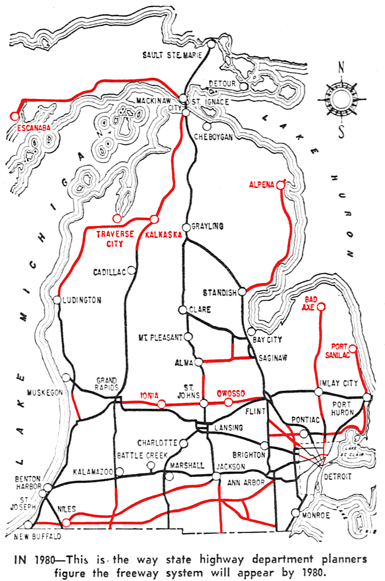
Projected 1980 Michigan Freeway System (1961)
In 1961, Michigan State Highway Department planners plotted their vision of what the state's future freeway system would look like in far-off 1980. On their map from 1961 below, the freeways highlighted in red were not contructed in the end. Some of them came close to being built, others were seemingly pie-in-the-sky ideas never making it past the planning map stage.
Of the red lines below, only two as of the 2020s have chances of ever being built: US-127 between Saint Johns and Ithaca and the US-31 Freeway in Ottawa County. Three segments not shown on the map were eventually constructed, however: US-10 from US-127 west to M-115 in 1975, the M-6 southern bypass of Grand Rapids in 2005, and the segment of I-696/Walter P Reuther Frwy between M-53/Van Dyke Ave and I-94/Edsel Ford Frwy in greater Detroit is not shown on the map, although this may have simply been a cartographic error.
This Map Presentation ©2023 Christopher J. Bessert. All Rights Reserved.